This blog post was already more than a year overdue, but now I just had the time to write our Mt. Kabunian hike which happened last December of 2017, so here it goes.
Mt Kabunian is part of the
Bakun Trio mountains which is popularly known as the "home of the kankana-ey god, Kabunian." According to a local legend,
"Kabunian", the legendary head of the gods always left golden plates of meat and rice on the trail to feed the tired and hungry people scaling the mountain. Duligen, who has been a recipient of this kindness, stole some plates, which he surmised would command a handsome price in the market. But Kabunian learned about his evil intention. Out of anger, the chief god embedded him on a rock and only had Duligen's now monstrously large phallus protrude as a reminder that evil never wins.
Some parts of the huge rocky mountainsides were used as a burial grounds, hence the presence of box coffins with human bones can be seen in some parts of the trail. Mt. Kabunian may not be that high but the trail can pose a great challenge to beginners most especially to those with serious acrophobia. With all honesty, it's one of the most dangerous trails I've ever been to. In fact, three of our colleague in the hike aborted the climb haft way through considering that they were all experienced hikers.
The trail has a total distance of 7km from Poblacion to the summit (14km for backtrail). The hike starts with a 900ft descent to a flight of cemented stairs which then leads to a gorge. It signifies the gradual ascent passing through stairs hewn from a rocky portion of a mountainside with some safety railings placed to aid the hikers during ascend and descend since most part is a ravine. Upon further hiking, one will reach a rocky portion with loose rocks, and one can only imagine how perilous the trail can be during rainy days. From there on, one will pass a very narrow mountainside trail which is actually less than a foot in width composed of loose rocks and soil with nothing to cling on. It was just pure guts to cross this route because one wrong move and you'll be hurtling down the mountain. Then comes the stairs hewn from the rocks which are very steep, thus safety railings were also placed to help the hikers which are approximately 200ft ascend where it features steep cliffs and rock drop-offs. It then leads to a hanging bridge that leads to the final 500ft steep assault to the summit that passes rocky mountainside trail for a total of 2400ft elevation gain from the jump-off point. Throughout our hike, there was a strong gushed of winds that were constantly challenging our every step which was comparable to 80km per hour (It was both scary and creepy as if the winds were mystical in origin. It miraculously stopped when decided to descend from the summit).
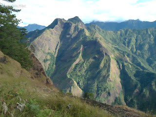 |
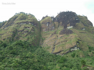
| The very scenic trail |
 |
| The summit at the other side |
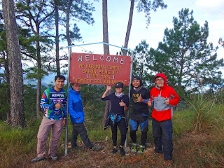 |
| Team Una ng LAQBAI at the summit (Photo credit: Ron Dubois) |
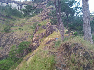 |
| The final 500ft assault to the summit |
 |
| The short hanging bridge before the final assault |
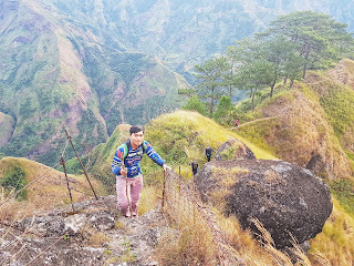 |
| Photo credit: Ron Dubois |
 |
| The perilous trail which is less than a foot wide |
 |
| The descent going back to jop (Photo Credit: Kiko San Luis) |
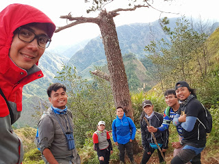 |
| Groupie muna s trail (Photo credit: Kiko San Luis) |
 |
| #GwapoBeLike (Photo Credit: Ron Dubois) |
 |
| @The summit: Emer, TenTen, Erwin, Ron & Kiko |
Hike date: Dec 15, 2017
***Special thanks sa mga nakasama ko sa hike na ito: Sir Emil, Mam Rita, Ate Bing, Mommy Daisy, Ten-Ten, Erwin, Reigner, Kiko and Ron Dubois and the rest of LAQBAI.
