Sunday, May 27, 2018

Buffet 101

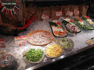
Buffet restaurants that feature cuisine and delicacies around the world have always been a constant favorite among Filipinos. With the influx of these restos, the quality of the food that are served are sometimes taken for granted. But as for Buffet 101 which is beside Mall of Asia, this seems not to be the case which is actually a sister company of Yakimix, thus one can be assured that their Japanese dishes are good. We had our lunch at Buffet 101 when my sister celebrated her birthday last February.

Upon entering, the facade would immediately catch your eyes. It has a modern architecture which displays comfort and the glass decors which boosts the luxurious ambiance. I just love how the whole resto brings life to the whole dining experience.

There are several cuisines that you can choose from which includes: Chinese, Japanese, Continental, Filipino, the carving table, the fresh seafood and of course the desserts. I personally find the layout of Buffet 101’s food stations a bit more organized compared to that of Viking's, the aisles in Buffet 101 are also wider and therefore more spacious. 

I found the food to be above the typical taste of most buffets. In my opinion, I like it better compared to that of Viking's. What I don't like about Buffet 101 is that it took them some time to replenish their empty food tray, and they have lesser meat and fish compared to Viking's.

Pinoy Solo HIker - Buffet 101

Pinoy Solo HIker - Buffet 101

Pinoy Solo HIker - Buffet 101

Pinoy Solo HIker - Buffet 101

Pinoy Solo HIker - Buffet 101


Pinoy Solo HIker - Buffet 101

Pinoy Solo HIker - Buffet 101

Pinoy Solo HIker - Buffet 101

Pinoy Solo HIker - Buffet 101


***In my opinion, Buffet 101 tastes much better compared to that of Viking's, but Viking's has a wider array of food selection.

Sunday, May 20, 2018

Mt. Marami

Located in Maragondon but the jump-off point of Mt. Marami starts in Ramirez, Magallanes, Cavite. "Marami" in the Tagalog language means numerous, thus the name perfectly describes the mountain's attributes. The trail is composed of a series of forks and labyrinth, thus the name can also mean as 'Maraming Ligaw" which passes through a forested yet muddy trail that could also mean as "Maraming Putik". The initial part of the trail starts a 500 ft descend from the jump-off point until reaching the first river crossing and even crossing a makeshift bamboo bridge. From there on the trail has a gradual ascent until the final 600ft assault to reach the summit which has an elevation of 1325ft. The whole trail has a total length of 19.6km through the backtrail which I personally describe as "Maraming Lakarin" for a minor hike. 

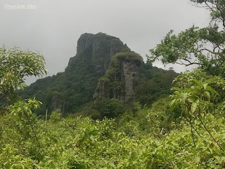
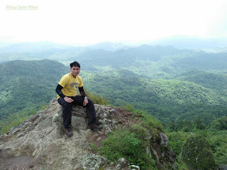
Just like the neighboring Pico de Loro, Mt Marami is also composed of enormous rock formations and massive composite of pillars and towers which is way challenging than the latter. Thus, this was primarily the reason why Mt Marami got it's named, "Maraming Bato" because the mountain is composed mainly of numerous and gigantic rocks. The trail will let the hiker to experience the “Silyang Bato” which is composed of composite rock pillars on the summit where it offers a refreshing strong gush of winds and picturesque 360° view of Cavite.

Pinoy Solo Hiker - Mt Marami

Pinoy Solo Hiker - Mt Marami

Pinoy Solo Hiker - Mt Marami

Pinoy Solo Hiker - Mt Marami

Pinoy Solo Hiker - Mt Marami

Pinoy Solo Hiker - Mt Marami

Pinoy Solo Hiker - Mt Marami


Pinoy Solo Hiker - Mt Marami

Pinoy Solo Hiker - Mt Marami

How to Get There:
1. Ride a bus bound for Naic (Saulog), usually in Coastal Mall terminal.
2. Then ride a bus bound for Magallanes.
3. Once in Magallenes you have to ride a trike to Brgy Ramirez which is the jump off point.

Monday, May 14, 2018

Hiking Together as a Team

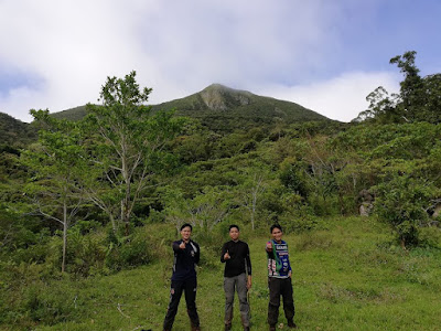
Pinoy Solo Hiker with the Team Una Outdoors


Hiking the trail with a group of people is a great way to strengthen camaraderie and get to know new people completely. The person at the Lead has a very important role in keeping the group together, safe and high in spirits.

Here are some important roles that a good trail leader should have.

1. Be Observant for the Trail Markers
Most trails are either marked with ribbons or crossed leaves/branches to help hikers stay on the trail, as well as avoid trampling vegetation and getting lost.

If the trail starts to get sketchy or unclear where it leads next, the leader should stop and think back to when they saw the last trail marker. If you can see another marker ahead, try to head straight towards it. It’s also possible you missed a turn and might need to head back to the last marker you saw to find the trail again.

That's why we at Team Una encourages getting a local guide for a sound and hassle-free hike.

2. Stop at Trail Junctions and other Forks
Any time the trail forks or presents multiple paths, it’s very important that you wait for everyone in your group to catch up before proceeding on with the trail.

The most common way that groups get split up and hikers end up lost is when they’re too spread out to see each other and end up taking different paths at the same junction. See to it that you can at least see or hear the person ahead of you and behind you. Always bring a whistle in case of emergency


3. Keep the Team Informed
A good trail leader knows what lies ahead, and keeps the group well-informed so everyone knows what to expect. Is the terrain beginner friendly? Are there wild animals, plants or limatiks? How far is it to the next water source? How long is the terrain? Screening of participants must always be practiced most especially for a major hike with ratings 6/9 and above, I don't recommend newbies to join such an event unless that person is a marathoner or an elite athlete.

Even if you’ve never hiked this trail before, you can answer a lot of those questions by doing some serious research. It’s a good idea to consult blogs ahead of time to see what people have said about the trail in general. 


4. Manage the Group's Pacing
There’s a common saying among hikers that you should “hike your own pace” and part of that means setting a pace that you are comfortable with.

But if you are the Pacer, it’s important to recognize how your pace impacts everyone else’s pace, and in turn, affects how they all feel about the hike.

If you’re going too fast, some people will try to keep up with you, pushing their heart rate up higher than they’d like, which will tire them down more easily and for some would eventually cause cramps. They’ll struggle more over steep terrain and need to take longer breaks to feel comfortable.

On the other hand, hiking too slowly can cause people to get jammed up behind you and will eat up more time which not follow the itinerary. This could have a great impact on morale if you’re not making good progress towards your group’s goal which includes places to visit, side trips and expected time to finish.

Be willing to adjust your pace and hike towards the middle or rear of the group if you sense that the pacing is getting slow because of people's morale during to relatively long trail.

During our descend from Mt Mcdo, I adjusted my pacing so that none of my groupmates will be left behind. It's more difficult to look for a missing teammate in the midst of a densely populated jungle most especially when darkness sets in.

5. Set Guidelines When Taking Rests
Whenever the group agrees to stop, it’s a great idea to quickly establish how long the break will be so that everyone is on the same page.

As a coordinator for some time, I usually try to establish whether the break will be:

2-3 Minutes - For grabbing a snack or water, or putting raincoat/ponchos
5-10 Minutes - Bathroom breaks, enjoying a quick view and taking pictures
20-40 Minutes - Eating a meal (breakfast, lunch or dinner) and enjoying the summit.

Make sure you stop for enough time that the person in the back has all the time they need to rest, take some trail food and take care of issues as well. I usually give 3-5 minutes for the last person to arrive depending on the steepness of the ascend or difficulty of the trail.


6. Safe Descend is More Important than Being the Fastest Hiker
If you’re the lead, it’s especially important to know how your decision-making can impact the rest of the group. What's more important is to ensure that all of your teammates are safe to descend back to jump off.

Taking ownership of the group can go a long way to make new hikers more at ease, earn their trust and most especially their respect.


***Credits to Hartley Brody from  https://adventures.hartleybrody.com/hiking-trail-leader/ for the content reference.

Sunday, May 6, 2018

Mt. Kalugong

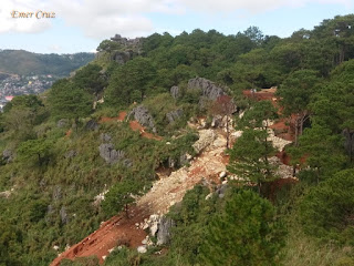
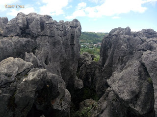
This is a sequel to my blog post about Kape-An sa Kalugong and Mt Yangbew which are all located in La Trinidad, Benguet also known as the Salad Bowl of the Philippines. Mt. Kalugong's summit is characterized by various limestone and rock formations which is similar to that of Mt. Pamitinan.

Mt. Kalugong which means "hat" in Ilocano is an eco-park that has an almost 400 ft. (395ft) ascent from the main road to the summit. There are several reasons why this mountain is quickly becoming popular. First, it has a coffee shop and a resto atop its summit. Second, it offers a picturesque view of the whole valley giving a panoramic view of pastureland and pine forests. Third, since it is an eco-park, there are several native huts, benches and tables, swing, and even zip lines erected in the conifer-covered area of the mountain making it ideal for the whole family. Fourth, it offers dramatic karst and limestones formations of different sizes and shapes. And lastly, it is just minutes away from Baguio City making it a great getaway from the busy and bustling city life for everyone who wants to commune with nature.

Pinoy Solo Hiker - Mt Kalugong

Pinoy Solo Hiker - Mt Kalugong

Pinoy Solo Hiker - Mt Kalugong

Pinoy Solo Hiker - Mt Kalugong

Pinoy Solo Hiker - Mt Kalugong

Pinoy Solo Hiker - Mt Kalugong

Pinoy Solo Hiker - Mt Kalugong

Pinoy Solo Hiker - Mt Kalugong

How to Get There:
1. From Baguio City, you can ride jeepneys bound for Tomay (terminal is in Magsaysay Ave.)
2. Tell the driver to drop you off at the junction to Brgy. Tawang 

***I joined an event organized by John Sarco

Tuesday, May 1, 2018

Mt Yangbew (Mt Jumbo)

One of the best-hiking destinations near Baguio City, Mt. Yangbew is also known as Mt Jumbo which is located in La Trinidad, Benguet and some locals also call it "Little Pulag of Benguet" because there are some occasions that it is engulfed by the sea of clouds. 

In my opinion, this is definitely one of the easiest hikes that are perfect for beginners of all ages which stands at 5,389ft above sea level. The ascent from the jump-off point to the summit is 480ft which passes through a cemented pathway until reaching a grassy portion. Despite its short elevation gain, you will be surprised that 80% of the trail is cardiac which give a higher elevation rise for a short time and can be reached within 30minutes of trekking. There are also available horses for rent if one wishes to take pictures or even ride around the summit.

The peak is characterized by an open grassland that offers a stunning 360-degrees surrounding view of Benguet and the Cordilleras including the recognizable radio transmitters of Mt. Cabuyao and Mt. Sto. Tomas from Tuba, Benguet. Karst and limestone formations can also be seen in the summit along with a radio transmitter.


Pinoy Solo Hiker - Mt Yangbew
Photo credits to Amor Cabasan


How to Get There:
1. From Baguio City, you can ride jeepneys bound for Tomay (terminal is in Magsaysay Ave.)
2. Tell the driver to drop you off at the junction to Brgy. Tawang 

***I joined an event organized by John Sarco