Sunday, November 27, 2016

Tatang's Lechon Cebu

After recent cravings with "Lechon" my office mates and I decided to try the newly opened Tatang's Lechon Cebu which is located in Mandaluyong. 

They are famous for their boneless and crispy lechon. The resto is a little bit small and can only accommodate 10 to 15 people. We were the only customer at that time (lunch) and they had no change for a 500 and 1000 peso bill, so better prepare for an exact amount if you wish to dine at their resto.

I ordered two Lechon value meal (Chili and Sisig), they are both good and tender while the pork skin is crispy, the meat is succulent that just melts as you chew, it is not the typical "lechon" - it is original Lechon.

The price is too expensive with minimal amount of serving, and since they claim to be the original Lechon Cebu - don't expect to have a "Sarsa ni Mang Tomas", bring your own.

Pinoy Solo Hiker - Tatang's Cebu Lechon

Pinoy Solo Hiker - Tatang's Cebu Lechon

Pinoy Solo Hiker - Tatang's Cebu Lechon

Pinoy Solo Hiker - Tatang's Cebu Lechon

Pinoy Solo Hiker - Tatang's Cebu Lechon

Rating:
6 out of 10

Friday, November 18, 2016

Mt. Arayat Traverse

Rising above to an altitude of 3360 feet over the plains of Central Luzon, Mt. Arayat is the most notable landmark of Pampanga. It is an extinct volcano with no recorded eruption and has become a favorite day hike near Manila with trails and difficult level which is comparable to MakTrav except that there are no Limatiks yet with a whole bunch of Mosquitoes instead. The traverse stretches a total of 14 km. with the entry trail at Magalang DENR station and ends in Arayat DENR station.

According to a local legend "Maria Sinukuan" is the fairy guardian who protects Mt. Ararat and is also inhibited by other mystical creatures, but in spite of the mystical stories surrounding the mountain, hikers are not deterred from exploring the beautiful yet very challenging mountain. 

I hiked with the Adventurous People then I would later found my climbing buddies with the same pacing as I do (Mildred, John, Jam and Anje) and we called ourselves as Team Una. We then started the traverse via Magalang DENR station, at the beginning of the trail we passed by large grottos which are part of "Stations of the Cross", our local guide told us that Catholic devout visits the place during Holy Week. The trail is forested with an established path that leads to the summit with a 2620ft elevation gain to the reach the Noth Peak where a telecom tower is located, which also serves as a police outpost. The peak is a plateau surrounded by grass slopes and can accommodate 10 to 12 tents which is actually the highest point in Mt. Arayat. 

The traverse becomes interestingly challenging upon the descend from the North peak towards the South peak. It is composed of a 620ft descend which includes rope segments, steep slopes which requires technical climbing and all sorts of maneuvering through vertical clay and rock walls. The trail is densely forested composed of Balite trees, Rattan and thorny bushes in a ridgeline that circles the broken Caldera of Mt. Arayat. Then after passing a ridge with a mossy forest one has to ascend 480ft through vertical walls that requires technical climbing where one will reach a huge boulder perched between two peaks known as "Haring Bato". Another thirty minutes of trek leads to the South Peak's viewing deck where it offers a rewarding view of Pampanga, Nueva Ecija, and nearby Central Luzon provinces.


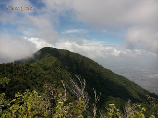
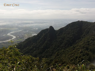
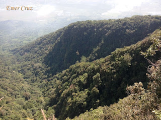
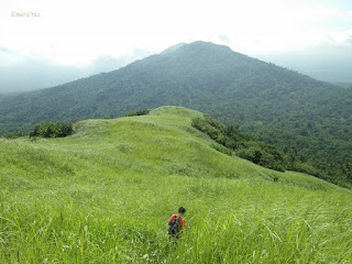
Pinoy Solo Hiker - Mt Arayat

Pinoy Solo Hiker - Mt. Arayat

Pinoy Solo Hiker - Mt Arayat
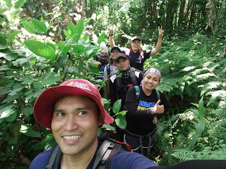
Dredd, John, Emer, Jam and Anje (photo credits)

Pinoy Solo Hiker - Mt Arayat
Bev, Dred, Patrick, Anje & Jam

Pinoy Solo Hiker - Mt. Arayat

North Peak
Pinoy Solo Hiker - Mt. Arayat (North Peak)
(North Peak as seen from South Peak's Viewing Deck)

Pinoy Solo Hiker - Mt. Arayat (North Peak)

Pinoy Solo Hiker - Mt. Arayat (North Peak)

Traverse Trail
Pinoy Solo Hiker - Mt. Arayat

Pinoy Solo Hiker - Mt. Arayat

Pinoy Solo Hiker - Mt. Arayat

South Peak
Pinoy Solo Hiker - Mt. Arayat (South Peak)
(South Peak as viewed from the North Peak)

Pinoy Solo Hiker - Mt. Arayat (South Peak)

Pinoy Solo Hiker - Mt. Arayat (South Peak)


How to Get There:
1. You can ride buses bound to Arayat from Monumento.
2. Another option is to ride a bus bound to San Fernando Pampanga.
3. Once in San Fernando you ride jeepneys bound to Magalang, then ride a hail a trike that will take you to DENR Registration (Jump off if you are interested to do a traverse)

Wednesday, November 16, 2016

Nuvali Road Trip


Nuvali is a sustainable community developed by the Ayala land and owned by the Yulo family which is located at the cities of Santa Rosa, Calamba, and Cabuyao in Laguna. It was formerly a sugar plantation in the late 1940's until was turned into an agro-industrial estate. It aims to be a wholly sustainable community where premiere business estate and nature coexist known as Evo Living.

Aside from business establishments, restaurants and shopping centers there are also leisure activities that you can do in Nuvali which includes: Biking, bike tracks are located in the area designed for leisure and off road bikers alike. There are also wakeboarding (Republic Waterpark), is a world class water sports facility which offers water ski, surfing and snow boarding. Koi Fish Feeding, one of the most popular activities to do in Nuvali, where a large outdoor pond is full of Koi. And of course, our favorite thing do is to ride the Speed Boat across the man made lake, it is a 10 minutes ride which cruises back and forth the lake.

Pinoy Solo Hiker - Nuvali

Pinoy Solo Hiker - Nuvali

Pinoy Solo Hiker - Nuvali

Pinoy Solo Hiker - Nuvali

Pinoy Solo Hiker - Nuvali

How to Get There:
1. One can ride UV Van Express bound for Nuvali

Thursday, November 10, 2016

Mt. Atimla

Mt. Atimla has an elevation of 2146 ft. and is usually climb together with the nearby Mt. Kalisungan for a twin dayhike. It takes an average of 6-7 hours to complete the traverse between the two mountains which starts from Kalisungan (entry point is Brgy Lamot) and ends in Atimla (exit point is Brgy Curva).

It lies between the Laguna de Bay and mountain ranges near the Banahaw complex and are surrounded by the famous seven lakes which are bounded by the towns of San Pablo, Nagcarlan, Victoria and mostly part of Calauan, Laguna. Mt. Atimla's summit is characterized by three distinct peaks but only one peak has a established trail and the two is yet to be explored for possible routes.

The descent from Mt. Kalisungan initially features going down through a very steep eastern portion of Kalisungan comprising of almost 70 degrees for about 400 ft. It has a total 1020 ft total descent to reach a valley that commences the assault to Atimla. It was so steep that it was actually my first time to sit and slide down during a descent with nothing else to cling on except the razor-sharp samurai grass.

Upon entering the trails of Atimla, one will be surprised that it is totally a forested woodland that is teeming with red ants, mosquitoes and a wide array of insects (It is recommended to wear long sleeves). From the valley, one has to ascend another 700ft to reach the summit which is like a jungle as seen from Jurrasic era untouched and unexplored. It is steep with no rocks and tree branches to cling on, just pure muscle power. 

The summit of Mt. Atimla is like the peak of Mt. Obabis, except that it is larger and the terrain is more varied. Almost like a plateau, except that it’s not very flat. The summit is surrounded by trees and vegetation, thus a 360 degrees view is not possible but one can still take pictures in strategic locations.

Pinoy Solo Hiker - Mt Atimla

Pinoy Solo Hiker - Mt Atimla

Pinoy Solo Hiker - Mt Atimla

Pinoy Solo Hiker - Mt Atimla

Pinoy Solo Hiker - Mt Atimla

Pinoy Solo Hiker - Mt Atimla


How to Get There:

1.) Take a bus bound to Sta Cruz, Laguna (DLTB or Greenstar), their terminal is in LRT Buendia.
2.) Tell the conductor to drop you off in Masapang.
3.) You can then ride a jeepney bound to Calauan/San Pablo tell the driver to drop you off in Brgy Lamot 2
4.)You will be requested to register and take a guide with you for safety purposes.

* I hiked with my fellow Team Una friends.

Tuesday, November 8, 2016

Push-Ups: The Classic Strengthening Exercise

Push-ups are one of the oldest and most basic form of strengthening exercises for a simple reason that it works. When I was a cadet in a military school, I hate doing push-ups (it was a form of punishment at that time). Until recently, I realized the benefits that I can reap with this classic strengthening exercise. It's no wonder why push-ups are included in military physical fitness test.

It targets all the muscles in the upper body: increasing endurance, stamina and builds optimal strength in the forearms, shoulders, chest. And when done properly, it also put emphasis on building a strong core by stabilizing the abdominals, back and even the quads.

A great exercise that can be done anywhere. No expensive equipment needed. No gym membership required. No trainer instruction is necessary. You don’t need to be in a group to do push ups. 

(Decline/Wide Shoulder Push-Ups: develops upper body strength and chest)

(Clapping Push-Ups: develops speed and explosiveness)

Saturday, November 5, 2016

I Survived EDSA on Foot

Friday night, rush hour and a heavy traffic is a perfect combination of going home most especially in the province like a living hell. 

Buses of all sorts were jam-packed with passengers, not to mention other passengers that were still waiting to get a ride. Riding the MRT looks reasonable but the long queue of passengers and the jam-packed train coaches made it not an option since  I was carrying a bulky backpack.

After 45 minutes of trying to get a ride, I've decided to walk from my office to the bus terminal in Cubao (it's the only chance I can have decent seat in the bus). EDSA is a long stretched of highway that was originally named as Highway 54 and was later changed to Efipanio Delos Santos Avenue or EDSA. Contrary to popular belief it is not 54 km. in length but rather it is only 23.8 km. that stretches from Monumento (Bonifacio Monument) to Pasay Rotunda near the bay area.

I was able to walk a total distance of 6.7 km (Boni to Cubao) in 1 hour and 15 minutes. Since I am quite aware about the perils of walking in EDSA alone at night, I made some necessary precautions. I was alert the whole time and I walked fast - so fast that I didn't have any rest and stops. I also kept my belongings safe and had avoided shady spots (Ironically, outside the gate of Camp Crame is the darkest spot in EDSA, lamp posts were not lit)

I came across several unpleasant smell of human excrement, the stench triggered my allergic rhinitis. It was quite an experience, something I am not interested to do it again.

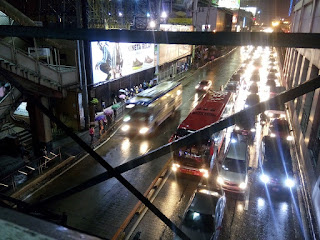
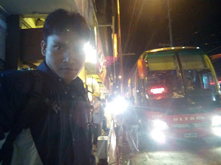
Pinoy Solo Hiker - I Survived EDSA on foot

Pinoy Solo Hiker - I Survived EDSA on foot

Pinoy Solo Hiker - I Survived EDSA on foot

Pinoy Solo Hiker - I Survived EDSA on foot


Here are some important reminders when walking at night:
1. Be alert and be vigilant of your surrounding.
2. Avoid shady spots
3. Walk fast
4. Keep your belongings safe.

Wednesday, November 2, 2016

Puerto Prinsesa Baywalk

Puerto Princesa Baywalk is the city’s own version of Manila Bay's Baywalk. It is a long stretch of park situtated beside the sea which is a scenic place to view the sunset and most especially the sunrise. One notable structure in the park is the emblem of Palawan’s Pheasant peacock which is an endangered species and is endemic to Palawan.  

Food stalls and several bikes are available which can be rented for a minimal fee. Boats can also be rented if you want to avail the firefly watching tour which will take you to Iwahig River. Iwahig River is surrounded by thick mangrove forests where fireflies display an enchanting sparkling lights in the night.


How to Get There:
1.) According to my sister's narration: "Once in Puerto Prinsesa, you can ride trikes to take you to the Baywalk"

Tuesday, November 1, 2016

Baker's Hill (Palawan)

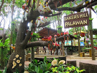
Baker's Hill is a bakery and a leisure park which is located on top of a hill. It started as a simple bakery which specializes in Hopia and Crinkles. Now they have expanded and created a theme park and botanical garden with additional establishments such as: the baker's kitchen, pizza house, zip line, hula shake, snack bar, view deck to name a few.

Scaterred around the leisure park are the botanical garden with floral arrangements and notable life size cartoon characters. The zip line and the view deck also offers a nice view of Honda Bay which can be seen from afar. Horse ride also available for a minimal fee.

They also have a souvenir shop where one can buy wide arrays of "pasalubong" items such as: printed shirts, key chains, accessories, etc. in case you don't have time to stroll around the city.

The location, uniqueness and of course the baked goodies made Baker's Hill famous among tourists who visits Puerto Prinsesa.

Pinoy Solo Hiker - Baker's Hill

Pinoy Solo Hiker - Baker's Hill

Pinoy Solo Hiker - Baker's Hill

Pinoy Solo Hiker - Baker's Hill

Pinoy Solo Hiker - Baker's Hill

Pinoy Solo Hiker - Baker's Hill

Pinoy Solo Hiker - Baker's Hill

Pinoy Solo Hiker - Baker's Hill

Pinoy Solo Hiker - Baker's Hill

How to Get There:
1. Once in Puerto Prinsesa, go to Rizal St. From there, ride a jeep with the signboard "Irawan".
2. Tell the driver to drop you off at the intersection going to Baker's Hill or Mitra's Ranch. From there, hire another tricycle to take you to both the places.