Thursday, July 27, 2017

All Hands Beach

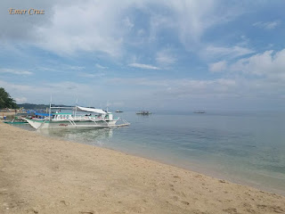
Situated between the Subic International Airport and Subic Container Terminal, the beach resort was formerly managed by the U.S Naval Air Station until 1991, but now it is currently maintained by Brighterday Subic Inc.

All Hands Beach was one of the favorite beach resorts by the U.S. Military men, together with the nearby Dungaree Beach and Officer's Beach. The name comes from the Naval term ''all hands on deck" which means everyone on deck, all ranks on deck or everybody on deck which requires involvement of all members of the team. 

The water is clear and pristine with calm waves that are not much higher than 6 inches in most time of the day, making it great for swimming even for kids. It is also far away from residential community and inland river making it pollution free.

There are several activities which includes: banana boat rides, water bicycling, kayaking, snorkeling and even Jet Ski driving.

Pinoy Solo Hiker - All Hands Beach

Pinoy Solo Hiker - All Hands Beach

Pinoy Solo Hiker - All Hands Beach

Pinoy Solo Hiker - All Hands Beach

Pinoy Solo Hiker - All Hands Beach

Pinoy Solo Hiker - All Hands Beach

Pinoy Solo Hiker - All Hands Beach

Pinoy Solo Hiker - All Hands Beach

Pinoy Solo Hiker - All Hands Beach

How to Get There:
1. From Cubao, you ride buses bound to Olongapo.
2. Once in Olongapo you can ride a taxi, tell the driver that you are going to All Hands Beach

Thursday, July 20, 2017

Mt. Pinagbandirahan (Gulugod Baboy)

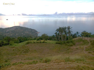
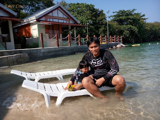
Located in the town of Mabini in Batangas, which is known for the diving resorts in Anilao. Mt. Gulugod-Baboy is a favorite hiking destination for outdoor enthusiasts due to its proximity from Manila and the picturesque view that it offers, making it a sea and summit climb. There are three peaks on the range and the third has a large tree known to hikers as the Gulugod-Baboy. Thus, each peak is named as "Gulugod-Baboy", "Gitna" and "Pinagbanderahan". It has an altitude of 1722 ft. above sea level and has a total of almost 1400 ft elevation gain from the jump-off point.

The first part of the trail passes through a cemented pathway, then the second part of the trail passes a shady and forested path (private property) which eventually leads to rolling terrains of grasslands. Upon reaching the summit one will be mesmerized by the Janao Bay, Maribacan strait, a faint outline of distant Mindoro, Verde Island, and Batangas Bay. Other exceptional scenery includes the Batangas mountains of Lobo, Mt. Pinamucan, Mt. Maculot, Mt. Batulao, the city and the port of Batangas City can be seen as well.

I was surprised that there is a parking lot, and I found out that the summit can also be reached by vehicles for those who just want to take pictures.

Pinoy Solo Hiker - Gulugod Baboy

Pinoy Solo Hiker - Gulugod Baboy

Pinoy Solo Hiker - Gulugod Baboy

Pinoy Solo Hiker - Gulugod Baboy

Pinoy Solo Hiker - Gulugod Baboy

Pinoy Solo Hiker - Gulugod Baboy

Eric, Ate Lin, Steph, Red, Harold, Rhaymand & Miguel (photo credit: Michael)
Yves, Michael and Emer (photo credit: Michael)


How to Get There:
1. From Manila, ride a bus bound for Batangas City Grand Terminal
2. Ride a jeep bound for Mabini (tell the driver to drop you off in Philpan Dive Resort)
***I joined an event organized by Eric Franz Copon

Sunday, July 16, 2017

Ambuklao Lake (Dam)

Situated in Bokod, Benguet province, Ambuklao Lake serves as a dam for Hydroelectric facility located on the upper Agno River and its tributaries the Bokod River which is 36 km. from Baguio City. It was developed in the late 1940's for the main purpose of hydroelectric power generation, flood control and irrigation. The main source of water comes from the Agno River which originates from Mt. Data.

The rockfill dam reaches a maximum height of  423 feet above the riverbed of  the Agno River. Several structures used by the hydroelectric power plant can be seen like the gated ogee spillway and the existing power station intake which is located to the right of the embankment that is connected via the power tunnel to an underground valve chamber and power house.

Pinoy Solo Hiker - Ambuklao Lake

Pinoy Solo Hiker - Ambuklao Lake

Pinoy Solo Hiker - Ambuklao Lake

Pinoy Solo Hiker - Ambuklao Lake

Pinoy Solo Hiker - Ambuklao Lake

Pinoy Solo Hiker - Ambuklao Lake


***I joined an event organized by Traveling Adventure

Saturday, July 8, 2017

Mt. Apo (Sibulan Traverse)

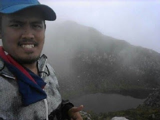
The highest mountain in the Philippines archipelago which is located between the provinces of Davao del Sur, Cotabato and the city of Davao, Mt. Apo stands at an altitude of 10,311 ft above sea level and is also known as the "Grandfather of Philippine mountains". There are three known trails that leads to the summit of Mt. Apo which includes: Kidapawan-Magpet Trail, Kapatagan-Kidapawan Trail and the Sibulan-Kapatagan Traverse which is the most challenging among the three.

My friend and fellow mountaineer John Sarco who had a day-hike traverse via the Sibulan trail shared his experience with regards to the strenuous but challenging route that is truly an experience of a lifetime. Thus, it was based on his pictures and narration that this write-up was made.

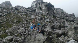
The Sibulan trail which is also known as the "Boulder Face" is literally composed of huge boulders, where one has to maneuver through a huge chunks of hot rocks while a cool gushed of wind in the trail makes it totally one of a kind, which makes it definitely not advisable for beginners. The trail also features a wide array of landscapes, virgin forests, crags, rivers, lakes, mossy swamps, volcanic structures, and crater of sulfuric deposits which has a putrid smell of sulfuric gases that is similar to rotten eggs.

Upon reaching the summit, one will be rewarded with a panoramic view of the surrounding provinces of Davao del Sur and Cotabato. Lake Venado which is the highest lake in the country can also be seen from the summit that is actually a crater.

According to his guide Kuya Ronnie Torlao who holds distinct awards such as "2017 Mount Haguimtan Mountain Trail King" and "2017 Boulder Face Team Relay Champion" says that the whole trail is approximately more than 40 km. stretch. They were able to finished the whole traverse in almost 14 hours.

Pinoy Solo Hiker - Mt. Apo

Pinoy Solo Hiker - Mt. Apo

Pinoy Solo Hiker - Mt. Apo

Pinoy Solo Hiker - Mt. Apo

Pinoy Solo Hiker - Mt. Apo

Pinoy Solo Hiker - Mt. Apo

Pinoy Solo Hiker - Mt. Apo

Pinoy Solo Hiker - Mt. Apo

Pinoy Solo Hiker - Mt. Apo

***John Sarco shares his pictures and experience with regards to his Mt. Apo day hike traverse via Sibulan Trail. Thus, it was based on his pictures that this write-up was made.

Sunday, July 2, 2017

Daclan Sulfur Spring

Daclan Sulfur Spring is located in Bokod, Benguet which is like a small lake consists of boiling mud that also emits sulfuric gases similar to Mud Springs of Mt. Makiling and Mt. Talinis. A strong putrid smell of sulfuric gases is present along the site which is similar to rotten eggs. 

According to Wikipedia, a sulfur spring is also known as "Fumarole" which originated from the Latin word "fumus" which means smoke. It is is an opening in a planet's crust, often located in areas surrounding volcanoes. It emits steam and gases such as carbon dioxide, sulfur dioxide, hydrogen chloride, and hydrogen sulfide. The steam forms when super heated water vaporizes as its pressure drops when it emerges from the ground.

Fumaroles may occur along tiny cracks or long fissures, in chaotic clusters or fields, and on the surfaces of lava flows and of thick deposits of pyroclastic flows. A fumarole field is an area of thermal springs and gas vents where magma or hot igneous rocks at shallow depth release gases or interact with groundwater.

Pinoy Solo Hiker - Daclan Sulfur Spring

Pinoy Solo Hiker - Daclan Sulfur Spring

Pinoy Solo Hiker - Daclan Sulfur Spring

Pinoy Solo Hiker - Daclan Sulfur Spring

Pinoy Solo Hiker - Daclan Sulfur Spring

** I joined an event organized by Traveling Adventure

References: https://en.wikipedia.org/wiki/Fumarole

Saturday, July 1, 2017

Atlaza Beach

Atlaza Beach is one of the popular Beach Resort located in San Pascual, Burias Island, Masbate. While some travelers prefer to pitch a tent in the nearby islands of Sombrero, Tinalisayan, and Animasola Island, Atlaza Beach Resort has the full amenities that includes: a bar, bustling kitchen and cottages, thus many chose to stay here for an overnight while exploring the other parts of Burias Islands.

The beach resort is surrounded by a long stretched of powdery cream/beige sand beaches, crystal-clear turquoise waters of the Pacific Ocean, unspoiled natural resources which offers both picturesque sunrise and sunset.

Pinoy Solo Hiker - Atlaza Beach

Pinoy Solo Hiker - Atlaza Beach

Pinoy Solo Hiker - Atlaza Beach

Pinoy Solo Hiker - Atlaza Beach

Pinoy Solo Hiker - Atlaza Beach

Pinoy Solo Hiker - Atlaza Beach

How to Get There:
1. Ride a bus bound for Naga City
2. From Naga, ride a jeepney or van to Pasacao Port which will take about thirty minutes to one hour.
3. Once in Pasacao, a two-hour boat ride will take you to Burias Island.
***My sister joined an organized tour and it was based on her account that this write-up was made.