Monday, October 30, 2017

Mt. Apayang

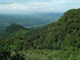
Situated in Nasugbu in Batangas, Mt. Apayang stands at 2172 ft. above sea level which is usually climb together with the neighboring Mt. Talamitan and is higher by 32 ft. The name was derived from it's attributes where the fog engulfs the whole summit giving it a vague visibility of the surrounding landscape.

It was also known to the locals as “Matandang Gubat” because majority of the mountain trail is densely forested and teeming with ants compared to that of Talamitan. Upon reaching the summit, one will be rewarded with a commanding view of Calatagan and Nasugbu that includes Batulao, Pico de Loro and Mt. Marami. The summit also has a strong gush of winds and cool breeze comparable to that of Tagaytay.

Pinoy Solo Hiker - Mt. Apayang

Pinoy Solo Hiker - Mt. Apayang

Pinoy Solo Hiker - Mt. Apayang

Pinoy Solo Hiker - Mt. Apayang

Pinoy Solo Hiker - Mt. Apayang

Pinoy Solo Hiker - Mt. Apayang

How to Get There:
1. Ride a bus bound for Nasugbu (DLTB)
2. Alight in Km. 83 Brgy. Aga which is the jump off for Talamitan.
3. If you have plans of trekking Mt. Apayang just tell the Brgy. Registration and guide.

Wednesday, October 25, 2017

Balayungan Falls

Situated in the densely forested town of Maragondon in the province of Cavite, Balayungan Falls is also known to the locals as "Pantihan Falls" because it is located in Brgy. Pantihan. The falls shares the same dramatic rock formations comparable to that of Pico de Loro and Mt. Marami, which offers a truly breathtaking scenery.

It has an approximate height of 50 ft. cascade which plunges to a wide catch-basin that serves as it's natural pool and is approximately 20 feet deep making it ideal for diving. It then feeds the Maragondon River formerly known as the San Diego River during the Spanish period. 

Several Nipa Huts are available for rent, making it a perfect place for outing and picnic.

Pinoy Solo Hiker - Pantihan Falls

Pinoy Solo Hiker - Pantihan Falls

Pinoy Solo Hiker - Pantihan Falls

Pinoy Solo Hiker - Pantihan Falls

Pinoy Solo Hiker - Pantihan Falls

How to Get There:
1. Ride a bus bound for Nasugbu
2. Alight in Magallanes crossing, asks for the locals about Pantihan Falls. 

Monday, October 16, 2017

Hiking Tips for your Knees


Knee Pain is a common symptom among hikers, runners and cyclists. One of the most common type of pain is around or behind the kneecaps commonly known as “runner’s knee.” The symptoms of this type worsens when walking up or down stairs, walking uphill, running, jumping or activities that force the knee to bear weight. It is often caused by worn out shoes or muscular weakness in the quadriceps and hamstrings. And for some hikers, the pain is often caused by trauma or overuse.

According to Dr. Vivian Sebastian, physiotherapist and trek leader at Indiahikes “Trekkers usually are scared and put excessive pressure on the knees while hiking downhill, causing their knees to swell. You need to let gravity carry half your body weight. It is a technique that the body needs to learn.” So do not attempt to hold yourself back more than required, as braking too much during a descent causes the knee to have more pressure. Take advantage of gravity and hike down at a rhythmic pace, in my part I usually run during descent most especially if the trail is negotiable.

Here are some helpful tips that I can share to prevent or mitigate knee pain:

Build up your Leg Strength. 
Start doing squats and lunges while gradually increasing repetition, because by strengthening the muscles that stabilize the knee joint, it can make a big difference in preventing knee pain. Make sure that you do the proper form, doing it incorrectly can make your knees worse.

Stretch your Legs Before Hiking
Stretching the leg muscles before you begin the trek is essential as it allows your body to become more pliable and less prone to injuries. It is important to stretch your lower body and legs as these muscles are going to be worked on more intensely during the hike.

Turn Sideways on High Steps
This will allow stronger muscles in the legs to help, which in turn helps you step down more stable, so you don't hit the ground with your foot as hard, thereby decreasing the pressure on your knee.

Use Trekking Poles
It is beneficial in reducing as much as 25% of the stress on your knees when you are going downhill and also reduces the impact of hiking on leg muscles when ascending.

Wear Knee Support
Personally, I have not tried wearing Knee Support, but it can give your knees additional support most especially in relieving pain and inflammation in knees. 

Wear the right Shoes
What you wear on your feet is probably the most important consideration for any trekker. While choosing a hiking shoe, utmost importance must be given to its quality. Hiking shoes with shock absorbing soles and comfortably fit your feet will negate the impact of any shock endured during hikes.


Reference: https://www.theadventurejunkies.com/hiking-knee-pain/

Sunday, October 15, 2017

Juag Lagoon Fish Sanctuary

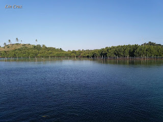
Situated in Matnog, Sorsogon and part of the island tour itinerary when going to Subic Beach and Tikling Island. Juag Lagoon is a privately owned fish sanctuary maintained by the Geneblazo family. Their native hut was built on a sandbar standing through stilts in the middle of the lagoon, which is surrounded by fish pens spread across the area. It was opened to tourists to give awareness and educate the public about preserving marine life. 

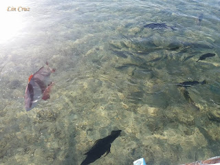
The sanctuary prides itself with crystal-clear blue waters, teeming with a wide variety of sea creatures including lobsters, coral fishes, giant clams, grouper, sea turtles and many others. Visitors can feed the fish in the sanctuary with fish pellets sold at the entrance. 

Pinoy Solo Hiker - Juag Lagoon

Pinoy Solo Hiker - Juag Lagoon

Pinoy Solo Hiker - Juag Lagoon

Pinoy Solo Hiker - Juag Lagoon

Pinoy Solo Hiker - Juag Lagoon

Pinoy Solo Hiker - Juag Lagoon

***The following pictures was shared to me by sister who went on a Sorsogon tour. Thus, it was based on her pictures and narration that this write-up was made.

Sunday, October 8, 2017

Bulusan Lake

Situated at the heart of Bulusan Volcano National Park in Sorsogon, Bulusan Lake is nestled between lush green vegetation teeming with rich flora and fauna located at the southeast flank of Mount Bulusan. The whole place offers a picturesque view with Mt. Bulusan serving as it's backdraft, thus it was dubbed as the "Switzerland of the Orient" and making it a favorite place for photo shoot. In fact, this is where Sen. Chiz Escudero and Heart Evangelista held their prenup photo shoot.

Due to it's expansive biodiversity, many locals can be seen fishing in the lake, which is about 60 ft. deep and has a circumference of 1.8km. The lake can also be explored by kayaking and aqua cycles, and there are several waterfalls, springs, and hiking trails that can be arranged if one wishes to explore the whole park at the tourism's office.

Pinoy Solo Hiker - Bulusan Lake

Pinoy Solo Hiker - Bulusan Lake

Pinoy Solo Hiker - Bulusan Lake


Pinoy Solo Hiker - Bulusan Lake

How to Get There: 
1.) From Legazpi, ride a GT Express in Tahao Road or Daraga bound for Irosin or Bulusan.
2.) Alight in Irosin junction from where you can get a trike ride to the terminal for jeepneys bound for Bulusan. 

Sunday, October 1, 2017

Mt. Pigingan

Situated in Dalupirit, which is one of the lowest point in Itogon, Benguet. Mt. Pigingan maybe a minor climb but it is known for it's scenic trail including its own version of a knife-edge. It has an elevation gain of 3100 ft. from the jump off to the summit with a total distance of 21 km through the back trail and stands at 4265 ft. above sea level.

It is lesser known compared to the neighboring Mt. Ugo and Mt. Ulap, but nonetheless, the picturesque view of its trail makes it a must-see among the mountains in Benguet. The trail leading to the summit are all manageable and perfect for beginners. We started our trek through a established pathway with a minimal ascent that passes through a river and then crossing a 100-meter hanging bridge. From there on, the trail gradually becomes steep which is comprised of assault and some portions have even loose soil/rocks. 

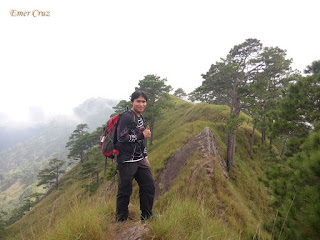
Only 20 percent of the trails are covered with trees and most are exposed grassland slopes. Even though it is located in Benguet, there is no soothing cool breeze that can compensate for the scorching heat of the sun. It only becomes densely forested with pine trees and even wild berries at the last part of the trail which commenced the assault to the summit which is characterized by a 50 ft. knife-edge ridge. One has to scramble through rocks to reach the top which offers a picturesque view of the surrounding town of Itogon, Benguet.

Pinoy Solo Hiker - Mt Pigingan
The 50ft knife edge that leads to the summit

Pinoy Solo Hiker - Mt Pigingan

Pinoy Solo Hiker - Mt Piginganv

Mike, Emer, Byron & JC

Pinoy Solo Hiker - Mt Pigingan

Pinoy Solo Hiker - Mt Pigingan

Pinoy Solo Hiker - Mt Pigingan

Team Una: Michael, JC & Emer

Pinoy Solo Hiker - Mt Pigingan
Wild berries along the trail

Pinoy Solo Hiker - Mt Pigingan
The 100-meter hanging bridge at the initial part of the trail

Pinoy Solo Hiker - Mt Pigingan
The scenic river at the start of the trail

***Me and my fellow Team Una members joined an event organized by John Sarco of the Rock Jockers