Labels

Showing posts with label Team Una. Show all posts

Sunday, April 3, 2022

Mt Pinatubo via Sapang Uwak (Delta V)

Mt. Pinatubo is situated between the provinces of Pampanga, Zambales and Tarlac. It is considered as the beauty that rose from destruction which is one of the most famous destination in Central Luzon.

When Mt. Pinatubo erupted in 1991, it became the second largest eruption in the 20th century that causes billions of damages to properties, crops and deaths to countless lives. 

My first visit to Mt Pinatubo's crater lake is via the Skyway and my second visit which I am sharing in this blog is our dayhike to Mt Pinatubo via Sapang Uwak that traverses around Pinatubo's crater rim and also traverses nearby Mt. McDonald.


Based on my Strava recording, Pinatubo via Sapang Uwak or Delta V has a total trail distance of 46.2km, if you ride a "habal-habal" it means you only hike 38.5km.

From the registration center the trail starts with a cemented/rough road with a gradual to moderate ascend until reaching the junction for a total of 1000ft elevation gain. From there on, one will descend a very steep forested pathway composed of loosed sand/ashes for a total of 1100 ft which then leads to a river bank that signifies the start of river crossing in Sapang Uwak.

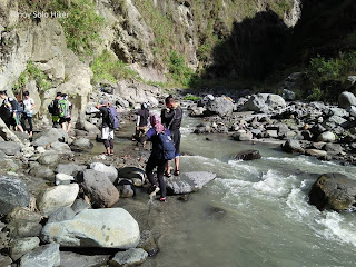
"Sapang Uwak" is actually part of the Pasig Potrero river, and during the lahar flooding in the early 90's, the Army set a watch point in the river whose company are called Delta V. Traversing Sapang Uwak is quite an adventure itself which also requires river trekking which at some point the current are quite treacherous most especially during heavy rain. There are also some portions that requires bouldering among huge rocks. 

Sapang Uwak
Pinoy Solo Hiker - Mt Pinatubo

Pinoy Solo Hiker - Mt Pinatubo

Further river trekking would lead to Apo Mallari falls which signals the end of the river trekking. Apo Mallari Falls is actually 12.5km from the jump off point.

Apo Mallari Falls
Pinoy Solo Hiker - Mt Pinatubo

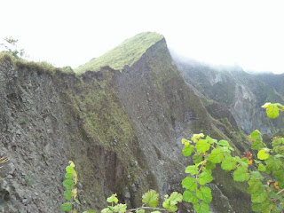
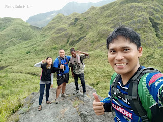
From the falls, the trail that then leads to Pinatubo's crater rim is moderate hike that passes through huge rocks which also requires bouldering and technical climbing on two vertical walls (10 and 15ft). When you have reached the crater rim it means you have hiked a total distance of 25km from the jump-off with a total of 3600 ft elevation gain. The Sapang Uwak trail would lead you around the crater rim composed of loose ashes/sand which at some point may collapse and cause landslide. 

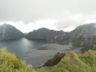
It offers unobstructed view of Mt Pinatubo's crater including, the nearby Mt Mcdo and the other unnamed mountains in the nearby terrain.

Mt Pinatubo Crater Rim
Pinoy Solo Hiker - Mt Pinatubo

Pinoy Solo Hiker - Mt Pinatubo

Pinoy Solo Hiker - Mt Pinatubo

Pinoy Solo Hiker - Mt Pinatubo
With Jem Paz and Kuya guide

Pinoy Solo Hiker - Mt Pinatubo

We took some pictures and rest for a few minutes then decided to proceed with the hike. It started to rain pretty hard when we descended Mt Pinatubo for a total of 700 ft until we reached a valley. From there on, our guide told us that we need to ascend a vertical wall of around 900ft in order to reach Mt. McDonald's summit. It was raining and the trail/stones were quite slippery and it requires great focus because the ascent requires technical climbing. The summit of Mt McDo marks the 27th km of the trail.

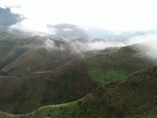
Mt McDo's summit is like a huge plateau which is actually called a helipad. The summit itself is characterized by a 360 degrees picturesque view of nearby Mt. Negron, Mt Pinatubo's summit crater, hills, and unnamed peaks. 

We waited and regrouped in the summit for more than an hour. Furthermore, the guide told us that the Zombie trail during the descend is actually confusing and tiring, thus hiking as a group is greatly encouraged.

Mt McDo
Pinoy Solo Hiker - Mt Pinatubo

Pinoy Solo Hiker - Mt Pinatubo

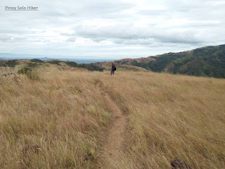
The start of the Zombie trail would enter a grassland composed of overgrown "Talahibs", it has a total of 12km which also passes a forested trail that seems to be endless and at some portion creepy until reaching the junction which marks end of the trail. It is also the start of the established road which means you have hiked a total of 38.5km.

There are options to ride a habal-habal or proceed with the hike, I chose to proceed with the hike together with Michael, Ate Angel, Kuya Jeh, Jordan and Joshua to complete the full 46.2km of Pinatubo via Sapang Uwak.

Friday, July 5, 2019

Mt. 387 (Ghost Rock)

Situated in Caranglan, Nueva Ecija; Mt 387 is part of Talavera Watershed Forest Reserve along the Caraballo mountain ranges with a land area of 387.9 hectares, thus it is where it got its name. It is also known to the locals as "Batong Amat" in the local dialect which means "Ghost Rock" because the remains of those who died during World War 2 were buried most especially the Japanese soldiers. The whole place also served as a barracks and Japanese camp and there where instances that rusted armaments can still be dug up. 

To some, Mt 387 was also known as the "Chocolate Hills of North", well honestly I don't see any resemblance at all, it looks like more of an uneven "Chocolate Hills" and the numbers of slopes are quite few to compare. My apologies but I don't agree with some bloggers or these promotional ideas. For me, it is already beautiful and awesome in its own right, no need to compare it with another landmark just to get attention whatsoever. 

The 387 hectares of the mountain range was awarded to "Kalinga sa Kalikasan ng Puncan" (KAPUNCAN) headed by Sir Roy Manuzon. Their group have agreed with DENR to protect and preserve the land area, thus each visitors (hikers and travellers) alike are requested to plant a tree each time they hike Mt. 387 which is part of the reforestation initiatives.

The initial part of the trail is forested until reaching an open grassland until it leads to a huge pile of rocks known as the "Ghost Rock" where the remains of those who died during WW2 were buried. Then another 5 minutes of trekking will lead to the famous landmark known as the "Lover's Tree", it is the only tree in the vast open grassland. According to some local legend that circulated among the outdoor community "Whoever climbs the said tree will be lovers or they will find their lover". The summit is characterized by a ridge that offers a 360-view of the Caraballo Mountain Ranges.


Pinoy Solo HIker - Mt 387
Dubbed as the "Chocolate Hills of the North"

Pinoy Solo HIker - Mt 387
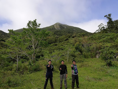
Team Una: Emer, JC & Michael

Pinoy Solo HIker - Mt 387

Pinoy Solo HIker - Mt 387
Batang Amat aka Ghost Rock

Pinoy Solo HIker - Mt 387
Team Una @ Ghost Rock

Pinoy Solo HIker - Mt 387

Pinoy Solo HIker - Mt 387
Tree Planting

Pinoy Solo HIker - Mt 387

Pinoy Solo HIker - Mt 387


Pinoy Solo HIker - Mt 387
Lover's Tree

Team Una Family


Pinoy Solo HIker - Mt 387
Team Una Family

How to Get There:
1. Ride any bus bound to Tuguegarao.
2. Alight in Km 175 Brgy Puncan in frfont of Iglesia Ni Cristo
3. Or ride a bus bound to San Jose, Nueva Ecija.
4. Once in San Jose, you can ride a trike to the jop.
Sir Roy Manuzon (09175712152)

***I joined an event organized by Team Una

Monday, September 3, 2018

Maranat Falls

Maranat falls is part of Mt. Oriod which is located Norzagaray, Bulacan. It is usually hiked together with Mt Balagbag like we did as part of our year-end hike. It is important to know that it is required to get a permit from DENR Bulacan before you plan of going to Maranat Falls since this is a part of Ipo Watershed.

From Mt. Balagbag towards Maranat Falls, one will pass a establish grassland then descend a very slippery and forested trail for a total of 1500ft descend. From there on the trails which leads to Maranat Falls requires several river crossing that passes huge boulders for a total of 3.5km.

The last portion of the trail that leads to Maranat Falls requires some bouldering through slippery rocks and even fallen logs. The falls is characterized by a 3 tiered drop that feeds a catch basin with portions that are deep and we were discouraged by our guide not to swim near the cascade. The water is cold and crystal clear which offers a refreshing dip but not ideal for diving. 

Since Maranat Falls is a backtrail, we have ascended a total of 1500 ft that passes a forested trail and an open grassland on the way back to Mt. Balagbag.

Pinoy Solo Hiker - Maranat Falls

Pinoy Solo Hiker - Maranat Falls

Pinoy Solo Hiker - Maranat Falls

Pinoy Solo Hiker - Maranat Falls


Pinoy Solo Hiker - Maranat Falls

How to Get There:
1. From Cubao, ride a bus bound for Tungko (alight in Jollibee).
2. From Jollibee Tungko, ride a jeep bound for Licao-Licao
3. You can ride trikes towards Mt Balagbag or you can take a walk (we walk of course).
4. If you are interested to visit Maranat Falls you should first secure a permit from DENR Bulacan and it is also advisable that you get a guide since this is a part of Ipo Watershed which is part of Bulacan.


***DENR PENRO is located in McArthur Hi-way, Guinhawa, Malolos, Bulacan. 
Bring a letter of intent together with the names of the participants, or you may email it to denr_bulacan@yahoo.com

Contact numbers: 044-7947090, 044-6620434 & 044-7940152 


No Permit, No Climb. Wag Matigas ang Ulo...

It was Team Una's year-end DIY KKB hike 

Monday, May 14, 2018

Hiking Together as a Team

Pinoy Solo Hiker with the Team Una Outdoors


Hiking the trail with a group of people is a great way to strengthen camaraderie and get to know new people completely. The person at the Lead has a very important role in keeping the group together, safe and high in spirits.

Here are some important roles that a good trail leader should have.

1. Be Observant for the Trail Markers
Most trails are either marked with ribbons or crossed leaves/branches to help hikers stay on the trail, as well as avoid trampling vegetation and getting lost.

If the trail starts to get sketchy or unclear where it leads next, the leader should stop and think back to when they saw the last trail marker. If you can see another marker ahead, try to head straight towards it. It’s also possible you missed a turn and might need to head back to the last marker you saw to find the trail again.

That's why we at Team Una encourages getting a local guide for a sound and hassle-free hike.

2. Stop at Trail Junctions and other Forks
Any time the trail forks or presents multiple paths, it’s very important that you wait for everyone in your group to catch up before proceeding on with the trail.

The most common way that groups get split up and hikers end up lost is when they’re too spread out to see each other and end up taking different paths at the same junction. See to it that you can at least see or hear the person ahead of you and behind you. Always bring a whistle in case of emergency


3. Keep the Team Informed
A good trail leader knows what lies ahead, and keeps the group well-informed so everyone knows what to expect. Is the terrain beginner friendly? Are there wild animals, plants or limatiks? How far is it to the next water source? How long is the terrain? Screening of participants must always be practiced most especially for a major hike with ratings 6/9 and above, I don't recommend newbies to join such an event unless that person is a marathoner or an elite athlete.

Even if you’ve never hiked this trail before, you can answer a lot of those questions by doing some serious research. It’s a good idea to consult blogs ahead of time to see what people have said about the trail in general. 


4. Manage the Group's Pacing
There’s a common saying among hikers that you should “hike your own pace” and part of that means setting a pace that you are comfortable with.

But if you are the Pacer, it’s important to recognize how your pace impacts everyone else’s pace, and in turn, affects how they all feel about the hike.

If you’re going too fast, some people will try to keep up with you, pushing their heart rate up higher than they’d like, which will tire them down more easily and for some would eventually cause cramps. They’ll struggle more over steep terrain and need to take longer breaks to feel comfortable.

On the other hand, hiking too slowly can cause people to get jammed up behind you and will eat up more time which not follow the itinerary. This could have a great impact on morale if you’re not making good progress towards your group’s goal which includes places to visit, side trips and expected time to finish.

Be willing to adjust your pace and hike towards the middle or rear of the group if you sense that the pacing is getting slow because of people's morale during to relatively long trail.

During our descend from Mt Mcdo, I adjusted my pacing so that none of my groupmates will be left behind. It's more difficult to look for a missing teammate in the midst of a densely populated jungle most especially when darkness sets in.

5. Set Guidelines When Taking Rests
Whenever the group agrees to stop, it’s a great idea to quickly establish how long the break will be so that everyone is on the same page.

As a coordinator for some time, I usually try to establish whether the break will be:

2-3 Minutes - For grabbing a snack or water, or putting raincoat/ponchos
5-10 Minutes - Bathroom breaks, enjoying a quick view and taking pictures
20-40 Minutes - Eating a meal (breakfast, lunch or dinner) and enjoying the summit.

Make sure you stop for enough time that the person in the back has all the time they need to rest, take some trail food and take care of issues as well. I usually give 3-5 minutes for the last person to arrive depending on the steepness of the ascend or difficulty of the trail.


6. Safe Descend is More Important than Being the Fastest Hiker
If you’re the lead, it’s especially important to know how your decision-making can impact the rest of the group. What's more important is to ensure that all of your teammates are safe to descend back to jump off.

Taking ownership of the group can go a long way to make new hikers more at ease, earn their trust and most especially their respect.


***Credits to Hartley Brody from  https://adventures.hartleybrody.com/hiking-trail-leader/ for the content reference.

Saturday, September 30, 2017

Why We Are Team Una?


"Team Una" is composed of dynamic and professional individuals whose interest in the outdoors has taken them to established the group which means "First". They randomly met in previous hikes as solo joiners, then the vision of Team Una came into existence with the same ideals and love for the outdoors.

As a group, we have this motto: "Sama-sama tayong aakyat sa bundok at sama-sama din tayo bababa bilang magtrotropa. Walang Iwanan" and firmly believe friendship and relationship matters most, because we are not a profit-oriented group. 

We believe that the joiners should be prioritized in the event and that their satisfaction is of utmost importance. We believe in leisure hikes and travel over "buwis-buhay" hikes, because hikes must be enjoyed as a form of relaxation which is used to unwind one's mind and body after a week of intoxicating work rather than life threatening travel. We are here to help newbie mountaineers and other people rediscover the beauty of nature as a form of activity that is beneficial for one's physical fitness, enjoyment and life's passion. 

We do not adhere to illegal and backdoor hikes, because safety is our top most priority as a group. We believe the we must abide with the law as a citizen to have a worry-free trip. Our advocacies and principles matters to us, with each fellow traveler we travel with, we create meaningful and lasting memories.

With Team Una, your travel is not just an adventure because it also supports local guides, communities and we highly implement "Leave No Trace Principle" ensuring that we don't destroy the nature that God has created but rather cherished it with utmost respect and appreciation .

Let me just share this wonderful quote from Mahatma Gandhi: “A customer is the most important visitor on our premises. He is not dependent on us. We are dependent on him. He is not an interruption of our work. He is the purpose of it. He is not an outsider of our business. He is part of it. We are not doing him a favour by serving him. He is doing us a favour by giving us the opportunity to do so.”