Thursday, May 25, 2017

Calaguas Island

The Calaguas group of islands are located in Camarines Norte, Bicol Region. It includes the major islands of Tinaga, Guintinua, Mahabang Buhangin and Maculabo Island, as well as several minor islands. It is a two hour boat ride from Vinzons port.

Due to the influx of tourists, it has become one of the most popular tourists spot for backpackers which is tagged as the “Paradise”.  It is composed of long stretched of powdery white sand beaches, crystal-clear turquoise waters, unspoiled natural resources, rock formations on it's end which truly creates a picturesque sight to behold; making it worthy for every adventure seeker's bucketlist.

Calaguas is still undeveloped, there are no hotels or fancy resorts, but there are makeshift cottages and one can also rent and pitch a tent if one wishes to stay overnight.

Pinoy Solo Hiker - Calaguas Island

Pinoy Solo Hiker - Calaguas Island

Pinoy Solo Hiker - Calaguas Island

Pinoy Solo Hiker - Calaguas Island

Pinoy Solo Hiker - Calaguas Island

Pinoy Solo Hiker - Calaguas Island

Pinoy Solo Hiker - Calaguas Island

Pinoy Solo Hiker - Calaguas Island

How to Get There:
1. From Manila, take the Superlines bus which has direct trips to Paracale.
2. Once in Paracale, tell the driver to drop you off at the Caltex gas station and hire a tricycle going to the port.
3. At the port, hire a boat that will take you to Calaguas (Mahabang Buhangin). 

**This write up was based on my sister's account (she joined an organized event)

Monday, May 22, 2017

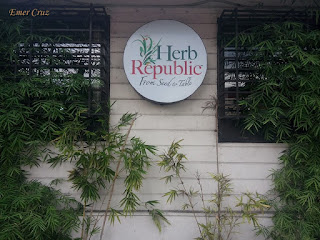
Herb Republic

This is actually one of the "must visit" restaurants in Los Banos, Laguna. With the resto's tagline "From seed to table", their goal is to provide organic vegetable, herb, and meat that ensures to have a fresh and healthy food suitable for everyone. 

The ambiance was very nice, it was like a home-turned-into-restaurant which has this "comfortable feel at home experience". They have several paintings on display and they even have a piano (just ask the attendants if you want to play). The best thing that I appreciate about their restaurant is that they employ deaf and mute which I'll definitely give a thumbs up for that.

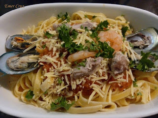
We ordered  Seafood Marinara which is greatly lavished with ingredients, it tastes great which is not too salty and perfectly soothes the taste palate. We also had Ciabatta Sandwich which uses a white bread filled with Chicken flakes and vegetable leaves. And of course we also had Guyabano and Banana Cooler, both topped with Gotu Kola leaves.

There are so many healthy options to choose from, so we'll be back for more.

Pinoy Solo Hiker - Herb Republic

Pinoy Solo Hiker - Herb Republic

Pinoy Solo Hiker - Herb Republic

Pinoy Solo Hiker - Herb Republic

Pinoy Solo Hiker - Herb Republic

Pinoy Solo Hiker - Herb Republic

Pinoy Solo Hiker - Herb Republic

Food Rating:
7 out of 10

Sunday, May 21, 2017

Manggahan Falls

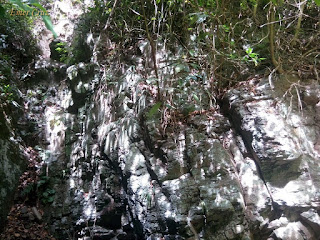
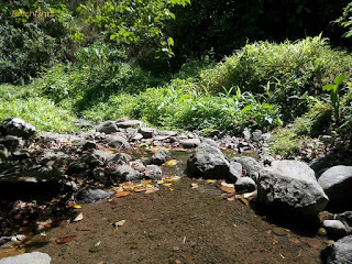
Though not as high compared to other waterfalls which is only 10 ft. of cascade. It is still a great sidetrip after descending from the summit of Mt. Sembrano which is just 400 meters away from the "Manggahan" campsite that requires descending and trekking through rocks and a stream.

It was named after the Mango (Mangga) trees that are abundant in the area, thus it was named "Manggahan Falls" but it is also known as "Kabayo Falls" to some. The water that cascades from the huge boulders is clear and ideal for washing, but since the catch basin is shallow (just below knee deep), it is not ideal for swimming and can only accommodate 10 person.

Pinoy Solo Hiker - Manggahan Falls

Pinoy Solo Hiker - Manggahan Falls

Pinoy Solo Hiker - Manggahan Falls

Pinoy Solo Hiker - Manggahan Falls

Pinoy Solo Hiker - Manggahan Falls

How to Get There:
1. Ride a jeep bound for Tanay, Rizal.
2. Once in Tanay ride a jeep bound for Pililia and tell the driver to drop you off in Brgy. Malaya to register and secure a guide

*** I joined an event organized by Laagan Outdoors.

Wednesday, May 17, 2017

Mt. Tangbaw

Standing at an altitude of 7195 ft. above sea level, Mount Tangbaw is one of the summits located along the Purgatory-Mangisi traverse. The summit is a flat grassland which serves as a campsite and can accommodate several tents; it offers a breathtaking view of Northern Bokod and Benguet province plus a myriad of pines trees.  

It also serves as one of the exit point for the descent traverse. Along the trail, several Benguet mountains can be seen from afar like Mt. Ugo, Mt. Timbak, Mt. Sto Tomas, the nearby Mt. Pulag and even the city of Baguio. The descent passes through a steep yet well established pathway that even motorcycles can access.

Our guide told us that the descent usually takes 3 hours to negotiate - I think he underestimated me and my colleague; we were able to finished the descent in just 56 minutes and had a total altitude loss of almost 3800 ft. upon reaching the jump off point (our guide was surprised, we were among the fastest to descent - of course we did some trail running to speed up the pacing). 

Pinoy Solo HIker - Mt. Tangbaw

Pinoy Solo HIker - Mt. Tangbaw

Pinoy Solo HIker - Mt. Tangbaw

Pinoy Solo HIker - Mt. Tangbaw

Pinoy Solo HIker - Mt. Tangbaw

Pinoy Solo HIker - Mt. Tangbaw

Pinoy Solo HIker - Mt. Tangbaw

Pinoy Solo HIker - Mt. Tangbaw

How to Get There:
1. Ride a bus bound for Baguio via Victory Liner
2. Once in Baguio, you can take a chartered jeep to Bokod Municipal/Tourism Office

Sunday, May 14, 2017

Balagbag Island

Located in the Province of Camarines Norte, Balagbag Island is situated beside Calaguas Island with it's highest peak standing at an estimated elevation of 125 feet.

According to my sister's narration, a fee of 25 pesos is collected as an entrance fee that will let you explore the hilltop. From the summit one will have a commanding view of the seemingly endless blue water of the Pacific Ocean. The coastline is composed of long stretch of beach with fine grain to pebbled white sand, and also features the stunning views of the rugged rock formation similar to that of Dingalan and Batanes which truly offers a paradise-like-setting.

Balagbag means “not correctly aligned or positioned” in Tagalog language, but since the island is in Bicol region, there might be other meaning for Balagbag. 

Pinoy Solo Hiker - Balagbag Island

Pinoy Solo Hiker - Balagbag Island

Pinoy Solo Hiker - Balagbag Island

Pinoy Solo Hiker - Balagbag Island

Pinoy Solo Hiker - Balagbag Island

Pinoy Solo Hiker - Balagbag Island

Pinoy Solo Hiker - Balagbag Island

Pinoy Solo Hiker - Balagbag Island

***My sister joined an organized tour on Calaguas and Balagbag Island.

Tuesday, May 9, 2017

Mt. Pack (Banskila)

Also known as Mt. Banskila and was later renamed as Mt. Pack which is one of the highest among the peaks along the Purgatory-Mangisi Traverse that stands at 7513 ft. above sea level.

From Mt. Mangagew the trek continues on a continuous ascent through an open and pine tree-forested trails that passes the Bangtinen campsite until reaching Prospect which opens the door to Mt. Pack and Purgatory. From there on hikers will be greeted with an endless mossy forest that goes all the way to Bakian. 

The cool breeze and dense forests counters the continuous ascending trail of Mt. Pack which has a total of 1772 ft. elevation gain from Mangagew. The summit is almost a plateau composed of mossy forests and green vegetation which offers a surrounding view of the towns of Benguet on one side and Nueva Viscaya on the other (mosquitoes are present, bring insect repellent).

Pinoy Solo HIker - Mt. Pack

Pinoy Solo HIker - Mt. Pack

Pinoy Solo HIker - Mt. Pack

Pinoy Solo HIker - Mt. Pack

Mossy Forest
Pinoy Solo HIker - Mt. Pack

Pinoy Solo HIker - Mt. Pack

Pinoy Solo HIker - Mt. Pack

How to Get There:
1. Ride a bus bound for Baguio via Victory Liner
2. Once in Baguio, you can take a chartered jeep to Bokod Municipal/Tourism Office

Monday, May 8, 2017

Mt. Mangagew

Situated in the Cordillera mountain ranges and is part of the Purgatory-Mangisi traverse, Mt. Mangagew is the first among the series of mountain ranges in Bokod, Benguet.

It stands at an altitude of 5741 ft. above level and has a total of 840 ft. altitude gain from the jump off point. The trail is mostly straightforward which is composed of endless pine trees and the slope is a continuous ascent with almost no flat stops.  

Upon reaching the summit, one will see a village, school, store and even a catholic chapel.  Vegetable and crop plantations can also be seen along trails which offers a picturesque view.

Pinoy Solo HIker - Mt. Mangayew

Pinoy Solo HIker - Mt. Mangayew

Pinoy Solo HIker - Mt. Mangayew

Pinoy Solo HIker - Mt. Mangayew

Pinoy Solo HIker - Mt. Mangayew

Pinoy Solo HIker - Mt. Mangayew

How to Get There:
1. Ride a bus bound for Baguio via Victory Liner
2. Once in Baguio, you can take a chartered jeep to Bokod Municipal/Tourism Office

Friday, May 5, 2017

Seoul Kitchen

Los Banos, has been a melting pot of different cuisine, among which is the Korean cuisine which has become one of the favorites among Filipinos. Tucked along F.O. Santos and Pearl St. in Umali Subd., Seoul's Kitchen is perhaps one of the best Korean restaurant in Laguna.

The ambiance is great and the food even greater which is comparable to authentic Korean cuisine. The prices are affordable and student friendly which also has a generous amount of serving, truly it is a pleasant surprise. 

My siblings ordered several menu which includes: Green Ice Tea Frappe, Maki, Tonkatsu, Bibimbop, Soy Chicken, Chapchae which indeed satisfied my Korean gastronomic cravings.

Pinoy Solo Hiker - Seoul's Kitchen

Pinoy Solo Hiker - Seoul's Kitchen

Pinoy Solo Hiker - Seoul's Kitchen

Pinoy Solo Hiker - Seoul's Kitchen

Pinoy Solo Hiker - Seoul's Kitchen

Pinoy Solo Hiker - Seoul's Kitchen

Pinoy Solo Hiker - Seoul's Kitchen

Pinoy Solo Hiker - Seoul's Kitchen


Pinoy Solo Hiker - Seoul's Kitchen

Food Rating:
8 out 10