Sunday, May 19, 2019

Mt Gozaisho

Standing at 3,969ft above sea level, Mount Gozaisho is the highest peak in the Suzuka Mountain ranges which is an hour travel from Nagoya, Japan. There are two options to reach the summit. The first one is by trekking up along the mountain by following the established trail which can be reached in two or three hours depending on one's pacing. And the other option is via a cable car known as the Gozaisho Ropeway which is Japan's longest ropeway which only takes 12 minutes to arrive at the summit.

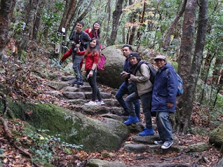
Each route offers a distinct experience and view in itself. The walking trail passes through a forested part with moderate assault that requires the use of bamboo ladders, ropes and chains to help one cross ravines and passed by jagged rocks with sheer drops on some portions. On the otherhand, the cable car travels over the treetops which offers a birds-eye view of cliffs, crags and rock formations.

On a clear day, Mt Gozaisho's summit offers a commanding view of Yokkaichi, Ise Bay and the Japan Alps, the Lake Biwa and, even the faint Mount Fuji which is nearly 300 km away. The summit also marks the border between Mie Prefecture and Shiga and the center of the Suzuka Quasi National Park. 

Depending on the season, during winter the view is mostly white and silver shining frost covered trees with snow-laden ski grounds. During spring it is filled with fresh cherry blossom and bright pink azaleas. While during summer the whole place is filled with lush green vegetation and the autumn season offers a stunning red, yellow and gold of the fallen leaves. Whatever season, Gozaisho offers a different experience all year round.

Pinoy Solo Hiker - Mt Gozaisho

Pinoy Solo Hiker - Mt Gozaisho

Pinoy Solo Hiker - Mt Gozaisho

Pinoy Solo Hiker - Mt Gozaisho

Pinoy Solo Hiker - Mt Gozaisho

Pinoy Solo Hiker - Mt Gozaisho

Pinoy Solo Hiker - Mt Gozaisho

How to Get There:
1. From Osaka, take the Kintetsu Ltd Exp (usually the Urban Liner from Osaka Namba, Uehonmachi, or Tsuruhashi) to Yokkaichi, then change to another Kintetsu train to Yunoyama Onsen.
2. Once you get there, you can take a long walk (4km), take a taxi, or bus to the Ropeway (there are two options via trekking or ropeway).

Tickets can be bought at ticketing offices and stations. Go to Osaka Namba, Uehonmachi, or Tsuruhashi, or you can also buy from ticket vending machines.

Try to visit their website: http://www.gozaisho.co.jp/en/access/#train

***This blog article was based on the pictures and narration shared by my brother-in-law (Rommel Garcia) that made this write-up possible.

Thursday, May 2, 2019

Mt. Balagbag

This write up was long overdue, we went to Mt Balagbag last December 2017 when "Garfield" the cute and floppy cat was still around who tirelessly entertained hikers and visitors alike.

Mt. Balagbag is a great hiking destination within the proximity of Manila which is located in San Jose Delmonte in Bulacan. Balagbag means “not correctly aligned or positioned” maybe that's how it got its name since it is located between the boundaries of Rodriguez, Rizal and SJD, Bulacan.

Because of its moderate slope, wide and established trail, it has become a favourite training ground for those who are beginning in their journey as a trail runner. Moreover, it is also one of the all-time favourites for those who are introduced into hiking since this is very accessible for commuters and can be hiked at one's convenience.  

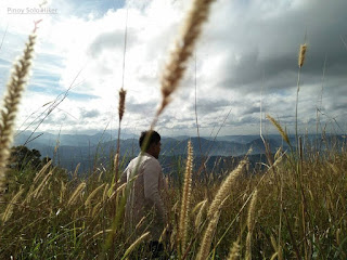
The start of the trek commences from Licao-Licao (one has the option to ride a trike which can cut the trekking time by 40 minutes). The trail passes a cemented pavement with gradual ascent until reaching the first registration point, from there on the trail leads into a pathway comprised of dirt and rocks ideal for mountain bikers which then leads into an open grassland with established trail ideal for runners, bikers and sightseers with a total distance of 5.8km all the way to the summit and an elevation gain of 1500ft. The summit offers a commanding view of Sierra Madre mountain ranges, Mt Oriod and even Metro Manila can be seen in the horizon. During that time we were welcomed by the cute and cuddly "Garfield the Cat", we were sad to learn that he is no longer around today.

Pinoy Solo Hiker - Mt Balagbag

Pinoy Solo Hiker - Mt Balagbag
Shooting place for "Goyo ang Batang Heneral"

Pinoy Solo Hiker - Mt Balagbag
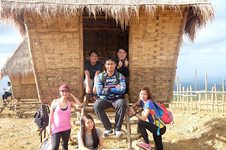
With the Team Una

Pinoy Solo Hiker - Mt Balagbag

Pinoy Solo Hiker - Mt Balagbag
Campsite

Pinoy Solo Hiker - Mt Balagbag
Gwapo be like

Pinoy Solo Hiker - Mt Balagbag

Pinoy Solo Hiker - Mt Balagbag

Pinoy Solo Hiker - Mt Balagbag
Garfield the Cat

Pinoy Solo Hiker - Mt Balagbag
Wazzupp Nigga?
How to Get There:
1. From Cubao, ride a bus bound for Tungko (alight in Jollibee).
2. From Jollibee Tungko, ride a jeep bound for Licao-Licao
3. You can ride trikes towards Mt Balagbag or you can take a walk (we walk of course).