Situated in Mt. Province which is located in the heart of Cordillera, Mt. Kalawitan stands at 8905ft above sea level and is considered as the 10th highest peak in the Philippines. This blog post was already long overdue, we hiked last April 28, 2018 via the "Kalawitan Circuit" which according to our guide is more challenging than the backtrail and the traverse. The circuit trail has a total of 35km distance, 17km from the jump-off point to reach the summit and the traverse via the circuit trail back to jump-off is 18km. As I have hiked Kalawitan Circuit and Namandiraan Traverse were I was both part of the lead group, I can honestly say that Kalawitan Circuit is more challenging. It has steeper rolling terrain which are all assault that leads to the summit and has a total elevation gain of 5350ft (4820ft jop to summit).
The name Kalawitan have originated from Kankakeny word "Kalawit" which means to climb, true enough Mt. Kalawitan is among the most challenging mountains in Cordillera alongside Amuyao and Napulauan. The initial part of the trail commences through a cemented pathway (Golden farm Resort) which then leads to a myriad of pine forests until reaching the first campsite where we regrouped and had our lunch. From there on, the trail becomes steeper which leads to a very thick mossy forest characterized by steep rolling terrains, infested with limatiks which only proves of its rich biodiversity. Since our hike was a circuit trail our guide told us that it was advisable to camp at the summit and not at the prior campsite which was still an hour away and usually used by those who go on a backtrail.
After seven grueling hours of hiking at the lead group where I followed the guide at his pacing, we finally reached the summit. It was raining that time, and the whole place were covered with fog and limatiks were everywhere but thank goodness they were not that aggressive. After minutes my teammates started to arrive, we then set our camp, had our dinner and socials afterward amidst the freezing cold.
I have been to Amuyao, Napulauan and Kalawitan and I can say that the latter is the coldest among the three considering that we did our hike during the month of April which was recorded at 7degrees. Amuyao (December @10degrees) and Napulauan (February @9 degrees) hike all were recorded at 1am.
The following day, I woke up early just in time for the sunrise where the whole place was still covered by a thick mist. Mt. Kalawitan's summit is like a plateau characterized by a summit marker, dwarf bamboos, and overgrown trees which makes a 360degree view, not a possibility. But by sheer patience and determination, one can still piece together images from various vantage points by stepping on a tree, I witnessed the magnificent sea of clouds which were also shared by the neighboring Amuyao and Napulauan on the other side.
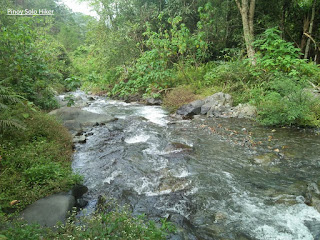
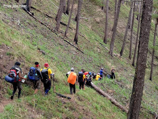
After we had our breakfast, we started the descend via the traverse circuit trail characterized by a very moist and steep inclination of 60-70 degrees passing through a very thick jungle with more aggressive limatiks as compared to the backtrail. The trail at that time was still semi exploratory with overgrown grass as we were among the first few groups who did the circuit trail for a total of 18km to reach the resort (jop) from the summit. The succeeding part of the trail then passes rolling terrains which consist of pine forest, river crossing, rice paddies and hanging bridge. Then the final phase of the circuit trail is a 500ft ascent to a cemented pathway which then leads to the stair path where the backtrail and circuit trail separates.
 |
| The tree at the summit which serves as the viewing deck |
 |
| Sea of clouds |
 |
L-R: Derrick, Emer, Bien, Memz, Mojo, Jumong
Rachel Anne, Katrina, Joward, Deesh, Jetro |
 |
| Tropang Kalawitan |
 |
| Trees at the summit |
 |
| The lead group while waiting sa mga ksama nmin |
 |
| The thick Mossy Forest |
 |
| The blogger with our rock star guide |
 |
| Pine trees at the descent |
 |
| Ferns and Pine trees |
 |
| One of the first few groups to do a circuit trail |
 |
| While waiting sa mga kasama, hokage pose muna. |
 |
| River crossing |
 |
| Rice Paddies which signifies the last part of the trail |
Personal Rating: 7/9 (Circuit trail) and 5-6/9 (Backtrail)
***I joined an event organized by Deesh Tan and Rachel Ann of Lunsulan Adventures.
Thank you sa mga nkasama ko sa hike na ito , kay Sir Bienvenido na nagpasilong sa amin s knyang tent, maraming salamat brod. Sa masayang tawanan na hatid ng mga Bagani Moutaineers na sina Sir Memz Moradillo, Joward, Jetro, Jumong, Derrick (birthday nya that time), Mojo at Katrina.
Photo credits nga pla sa mga groupies na pictures nmin, pag aari yun nila Memz Moradillo at Deesh Tan, kinopya ko nlang sa GC.


