Wednesday, December 12, 2018

Art In Island 3D Museum

As an artist myself, I know what looks good and not, and what is a masterpiece. So, when I learned about Art in Island, I immediately paid it a visit last April to check the jaw-dropping paintings that could turn the artistic side in you.

Pinoy Solo Hiker - Art in Island

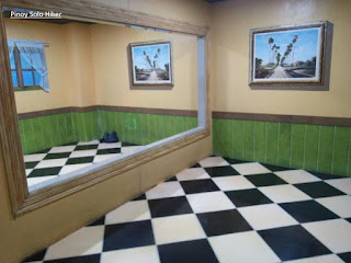
Art In Island Museum is located in 15th Ave. Cubao, Quezon City. It is a 3D museum where guests and visitors are invited to interact and “BE PART OF ART”.  It is actually the largest 3D interactive museum in Asia, with several hundred hand-painted attractions distributed into several themed-zones where guests can take photos as much as they want.

  • Aquatic Adventures (underwater zone)
  • Journey to the Jungle (animal zone)
  • Winter Wonderland (Christmas zone)
  • Religious (religious zone)
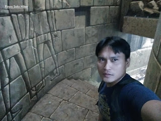
  • Ancient Times Dungeon (central hall)
  • Mysterious Walls (fantasy zone)
According to the museum staff, Art In Island was founded by Yun Jae Kyoung together with a team of several Korean painters who were called to do the project. The museum had more than 200 masterpieces which include bridges, mountains, animals, Egyptian ruins, Garden of Eden, Time Magazine and even a depiction of the North Pole all of which are 3D paintings. The paintings creates an illusion of depths and liveness which is perfect for Filipinos’ penchant with taking selfies and sharing them on Social media just like me.

There is also a 3D mapping presentation which depicts "The biblical creation, the great flood, Christianity up to the time period of missionaries and conquistadors which is the main highlight of the museum.

Some of the house rules that one must follow:
1. No shoes allowed
2. You can take pictures, but flash is not allowed

Pinoy Solo Hiker - Art in Island

Pinoy Solo Hiker - Art in Island

Pinoy Solo Hiker - Art in Island

Pinoy Solo Hiker - Art in Island

Pinoy Solo Hiker - Art in Island

Hirap tlaga pag solo ka, hanggang selfie ka nlang.

Pinoy Solo Hiker - Art in Island

Pinoy Solo Hiker - Art in Island

Pinoy Solo Hiker - Art in Island

Pinoy Solo Hiker - Art in Island

Pinoy Solo Hiker - Art in Island
Random kids that I took pictures of

Pinoy Solo Hiker - Art in Island

Pinoy Solo Hiker - Art in Island

How to Get There:
1. Go to Cubao, this is actually at the back of Araneta Center.
2. 175 15th Avenue, Quezon City, Philippines 1109

Wednesday, December 5, 2018

Mt Tenglawan

Ever since I started blogging, Bakun Trio particularly Mt Tenglawan has always been on my bucket lists because of it's iconic "Carrot Peak" and the awesome view that it offers. As a working and dedicated dad, I have a hard time finding a fitting hike schedule that my wife would approve. I was so thankful that Reigner Castro invited me to join their group which was organized by Emil Gannod of Laqbai, and since it was approved by my wife, to no avail, I immediately said yes.

I considered Mt Tenglawan among my top 5 favorite mountains that I've hiked, for the following reason that the summit offers a 360-degree view and of course it is not crowded with Social Climbers, so that you can truly enjoy your hike.

The blogger at the Carrot Peak of Mt Tenglawan

Among the mountains of the Bakun Trio, Mt Tenglawan is considered as the toughest. It has the longest trail with a total distance of 24.5km through the backtrail from Bakun Poblacion all the way to the summit characterized by a steeply inclined peak often described as "Carrot Peak" because it resembles a Carrot from afar. It has a total elevation gain of 4500ft through the backtrail (pabalik ng poblacion you have to ascend 1000ft, pauwi n yun ha).

We hiked Mt Tenglawan on the second day of our Bakun Trio itinerary. The trail starts from Poblacion which descends a 1020ft until reaching a river gorge. Then upon further trekking one will reach the hanging bridge which commences the start of the ascent which has a total of 3500ft altitude gain to reach the summit. I am so glad that I have hiked with 2 of the most "harkor hikers" that I've met namely: Kiko San Luis and Ron Dubois - who celebrated his birthday last December 4, Happy Birthday Lodi. Of all the strong hikers I've hiked with on the lead group, they are at par with the strongest laging pang 3rd lng ako s sequence namin tatlo, anyway balik ulit s blog write-up ko hehehe.

The trail gradually ascends through an open trail with some pine trees along the way even passing a giant cable lift used for transporting vegetable goods across the two mountains. Then another haft hour of trekking, our group reached a community where we refilled our water bottles. From the community, the trail is characterized by a rolling terrain until reaching a mossy forest infested by limatiks some of which are airborne (bgla nlang bumabagsak s ulo galing puno and one limatik fell directly at Kiko's head), from the hanging bridge until the mossy forest there is an equivalent ascent to 1600ft. From there on the trail passes rocky portions until reaching a very steep uphill assault which resembles the steepness of Mt Pulag's Akiki trail for a total of 2000ft elevation gain going to the summit. The summit is characterized by an open plateau which can accommodate at least 4-6 tents surrounded by ravines on all sides, but I am not sure if pitching tent is allowed. Just nearby the summit is the famed "Carrot peak" where one has to descend 30ft in order to reach the peak with an approximate height of 60ft where a cross is erected unto it's top. Safety railings were held in place to aid those who wish to scale the peak which is inclined at 70degrees.

The summit offers a 360-degree panoramic view of  Bakun and the surrounding Cordillera mountains. On the far North Mt Namadiraan and its different peaks can also be seen from afar, on the West is Tagudin, Ilocos Sur and La Union and on the Eastern portion, one can see Sagada and Mt Province.


The final 2000ft ascend similar to Akiki trail


Mt Namandiraan as seen from the summit

Bangar, Ilocos Sur as viewed from afar


At the top of the boulder, beside the Carrot Peak

Gwapo Be Like

Reigner, Erwin, Ten, Kiko, Bing, Emer & Ron (photo credit)

Team Una ng LAQBAI: Ron, Erwin, Ten, Emer & Kiko

Photo credits: Kiko, Emil, Bing, Ron, Ten, Emer & Erwin
Hike date: Dec 15, 2017
***Special thanks sa mga nakasama ko sa hike na ito: Sir Emil, Mam Rita, Ate Bing, Mommy Daisy, Ten-Ten, Erwin, Reigner, Kiko and Ron Dubois and the rest of LAQBAI.

Friday, November 16, 2018

Spectrum Linear Park

It is a special time of the year in Filinvest City, Alabang where Christmas season is felt in the air. The whole park is filled with music, singing, giant Christmas tree and musical light shows where it is transformed into a mini Christmas wonderland that includes the Tunnel of Light making it the main highlight of Spectrum Linear Park. According to some spectators, there were 3d mapping during the light shows last year, so it might still be the same today or much better. (soft opening nman ksi ako nagpunta kya hindi pa full operation hehe).

The Spectrum Midway Linear Park is a foliage-canopied walkway that spans across the north and south ends of the Filinvest City which offers a cozy and serene ambiance away from the noise and crowd of the buzzing city eventhough it is located in Alabang.

There are are also night market (Banchetto) which sells foods and dry goods.

Pinoy Solo Hiker - Spectrum Linear Park

Pinoy Solo Hiker - Spectrum Linear Park

Pinoy Solo Hiker - Spectrum Linear Park

Pinoy Solo Hiker - Spectrum Linear Park

Pinoy Solo Hiker - Spectrum Linear Park


Pinoy Solo Hiker - Spectrum Linear Park

How to Get There:
1.) From Edsa, ride an Alabang-bound bus. Alight in South Station or Alabang market and ride any jeep or bus passing by Zapote or Southmall. 
2.) Alight in the intersection of Alabang-Zapote Road and Filinvest Road. Walk to the corner of Acacia Hotel, and turn left at Commerce Avenue.

The easiest way is to walk passing through Festival Mall which exits at Commerce Ave., that's it. 

Tuesday, November 13, 2018

Mt Nagsasa (Bira-Bira)

Mt. Nagsasa is also known as Mt. Bira-Bira among the locals which is actually the smallest among the mountains in Zambales coastal mountain ranges and coves which stands at an altitude of 1470 ft. above sea level. It is usually hiked together with Mt Balingkilat for a complete Cawag Penta or Hexa traverse, or one can choose a much easier trail which is a traverse to Nagsasa Cove for a complete summit to sea experience.

The easy trail is an open grassland with a gradual ascent equivalent to 1020ft altitude gain from the jump-off point. But if it is a traverse coming from Mt. Balingkilat difficulty level becomes insanely a notch higher which involves technical climbing and scrambling. In fact, one must descend a total of 1950ft that passes steep ridges and rocky knife-edge trails that somehow resembles G2. It then becomes a rolling terrain until reaching a final 300ft ascend to reach the summit. The summit offers a 360-degree view of the surrounding mountain range of Zambales which includes Balingkilat, Dayungan, Cinco Picos and of course the picturesque view of Anawangin and Nagsasa Cove.

Pinoy Solo Hiker - Mt Nagsasa

Pinoy Solo Hiker - Mt Nagsasa

Pinoy Solo Hiker - Mt Nagsasa

Pinoy Solo Hiker - Mt Nagsasa

Pinoy Solo Hiker - Mt Nagsasa
The only picture I have  with my hike buddies sa Mt Nagsasa, bawi ako s Cawag

Pinoy Solo Hiker - Mt Nagsasa

How to Get There:
1. Ride a bus bound to Iba, Zambales (Victory Liner) and tell the conductor to drop you off in PNP Station of Subic. You also need to prepare a letter of intent before you can start your hike which will be submitted to PNP Subic.
2. Then ride tricycle going to Sitio Cawag, Mt. Nagsasa's jump off point.

*I joined an event organized by Jaime Dequinon of Akyat Tanaw Mountaineers
**I recommend Kuya Joel Soria as a local guide for Cawag mountains (Balingkilat, Nagsasa, Cinco Picos).

Sunday, November 11, 2018

Black and Brew

Located in Vega Center at Los Banos beside UP Gate, Black and Brew is a small cafe which serves breakfast meals all day. According to my friends, they serve one of the best tasting locally brewed "Kapeng Barako" in town with the strong bitter taste to kick-start your day. 

Since I am not a fan of hot coffee, I ordered Iced Machiatto teamed up with their famous Cheesy Mushroom Omelette which insanely tastes good. It was filled with the cheesy goodness of melted cheese for that creamy taste that stays in your mouth. I also had a combo meal consists of Tuna Sandwich and All-Meat Pasta but it just tastes like the usual but it was definitely a great value for its price because of the generous serving. Then for dessert, I tried their Matcha Cheesecake which I had for haft the price because it was nearing its expiration date but nonetheless, it still tastes great.

The place is small and simple yet they serve one of the best value meals suited for your budget. Thus, it has become a favorite hang out among students who looks for a quiet place to study and at the same time enjoy the rich goodness of coffee and other house specialties like Tuna Alfredo and Cheesy Omelette.

Cheesy Mushroom Omelette w/ Embutido slice

Pinoy Solo Hiker - Black and Brew

Pinoy Solo Hiker - Black and Brew

Pinoy Solo Hiker - Black and Brew
Pasta and Sandwich Combo

Pinoy Solo Hiker - Black and Brew
Matcha Cheesecake

Pinoy Solo Hiker - Black and Brew
Iced Machiatto


Location: 2F Vega Center, Los Banos, Laguna

Friday, November 2, 2018

Mt Irid

Situated in the Sierra Madre mountain ranges which borders Tanay, Rizal and Gen. Nakar of Quezon province. Mt Irid stands as the highest peak in the province of Rizal and was opened to the hikers last 2013. It has an altitude of 4790 ft above sea level and has a total of 31 km. through the backtrail (15.5km to reach the summit), but local says its 38km backtrail, I'll just stick with my own data recording as I usually do.

This was a indeed memorable hike because my trekking shoes was forced into retirement on the actual hike which gave me a hard time. I just tied the shoelace around it, so that I can continue with the ascent to the summit and descend back. And of course, this is one of those dayhikes where we had "socials" on one of the most enchanting waterfalls (Kinabuan Falls) and even an unexpected "engagement proposal".

The trek starts from Sta. Ines Brgy Hall which initially passes a established trail passing 11 river crossings and several nameless mountain base passes until reaching Sitio Kinabuan where the enchanting Kinabuan Falls is located. From there on, a further hike will lead to Sitio Sadlac where one has gradually ascended a total elevation of 1610ft. from the jump-off. This is usually where hikers who go on an overnight hike set up their camp where bunkhouses, campsites and even a store can be found characterized by open grassland surrounded by the neighboring Mt Tukduang Banoi and Mt. Parukpok.

The real challenge of the trek starts with Mt Irid's base where one enters a very forested trail which commences the pure ascend of 2005ft altitude gain to reach the summit for a total of 3615ft altitude from the jump off to the summit. The trail is characterized by limestone formations and roots which can be found along the trail that requires some technical climbing, rock scrambling and even body contortions, something that resembles Mt Makiling and Mt Daraitan combined, except that Mt Irid is longer and higher with the teepness of 60-70degrees on some part. Like most virgin forests several flora and fauna can be found like Rafflesia and of course Limatiks which abundantly abound in its trails making it my personal choice as the toughest mountain in the province of Rizal (as mentioned earlier it forced my trekking shoes into retirement on the actual hike).

The summit of Mt Irid is characterized by numerous limestone formation often referred to as it's own version of "Rockies". There is also an encryption written by the Dumagat Tribe which tells about their commitment to protect Mt. Irid. On a clear day, it offers a picturesque view of the southern ranges of Sierra Madre including Mt. Tukduan Banoi which is located adjacent to Irid, making the formidable Sta Ines Trilogy that also includes Mt Parukpok.

Pinoy Solo Hiker - Mt Irid

Pinoy Solo Hiker - Mt Irid
Team Una @ Mt Irid

Pinoy Solo Hiker - Mt Irid
Photo Credit: Eric Copon (Team RSJ)

Pinoy Solo Hiker - Mt Irid

Pinoy Solo Hiker - Mt Irid

Pinoy Solo Hiker - Mt Irid
A slight clearing

Pinoy Solo Hiker - Mt Irid
Mossy forest

Pinoy Solo Hiker - Mt Irid

Pinoy Solo Hiker - Mt Irid

Photo Credits: MB Ram of Lenteng Gala

Pinoy Solo Hiker - Mt Irid
Photo Credits: MB Ram of Lenteng Gala

Pinoy Solo Hiker - Mt Irid
One of the river crossing

Pinoy Solo Hiker - Mt Irid

How to Get There:
1. From EDSA Star Mall, ride a UV Express bound for Tanay and alight in Tanay Market.
2. You can then ride a jeep bound for Sta Ines.

***I joined an event organized by Eric Franz Copon

Before hiking Mt Irid, it is very important that you have submitted a letter of intent and secured a permit from the Municipal Office of Tanay.

Contact the following numbers:
Kagawad Toto: +639302355562
Pitoy: +639263652353