Showing posts with label lake. Show all posts

Monday, January 13, 2020

Taal Volcano Island (via Tabaro trail)

Taal Volcano may be small but it is considered as the smallest active volcano in the world. It is located in Taal lake which is the third-largest lake in the Philippines located in Batangas and home to the Vulcan point island. It is described as an island within a lake within an island, within a lake in an island, it may sound confusing but that's how complicated it's order. Contrary to popular belief, some may have thought Mt Binintiang Malaki and Mt Balantoc (the most prominent landmark as viewed from Tagaytay) as Taal volcano which is completely wrong.

We visited Taal volcano via Tabaro trail almost 2 years ago since we prefer to see the crater lake up close. If you to visit Taal volcano via the Tabaro trail, boat ride starts from San Nicolas, Batangas where one can see the Alas-as Bird Sanctuary; home of migratory Egrets and the dry lava field. According to our local tour guide, Mt Tabaro's crater was formed during the 1965 phreatomagmatic eruption. The trail starts from a established pathway that passes numerous rock formations that were formed from lava gully, most were black color that signifies rich in Iron mineral. The trail continues until reaching a sandy part filled with ashes which then leads to Mt. Tabaro, it was a backtrail and so we decided to head towards the crater lake of Taal. In order to reach the crater lake, one has to ascend a 340ft trail composed of sandy and ashes, then descend to 360ft to reach the crater lake.

Throughout history, Taal volcano has 34 recorded explosions since 1572 including the recent (January 12, 2020). According to Philvocs, 1754 and 1911 may have been the most devastating eruption.  According to the book The Mysteries of Taal, 1991 written by Thomas R. Hargrove, "Taal Lake was Salt Water prior to 1754. The huge 1754 eruption that lasted for 6 months from May to December 1754 changed the salinity of the water from salt to fresh water. It sank 5 Batangas towns formerly located along the shores like Tanauan, Taal, Lipa, Bauan and a lost town that was never revived named Sala. Because of that tragic eruption, the map of Batangas was drastically changed so you have to respect and adjust with nature and learn from its violent history."

I would describe the crater lake as so blissful and serene but at the same time, dangerous where it constantly smells sulfur due to its volcanic activity.
Pinoy Solo HIker - Taal Volcano
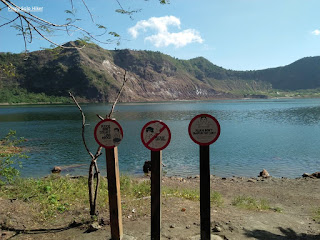
Taal Volcano crater lake

Pinoy Solo HIker - Taal Volcano

Pinoy Solo HIker - Taal Volcano

Pinoy Solo HIker - Taal Volcano


Pinoy Solo HIker - Taal Volcano
Taal Volcanic Island

Pinoy Solo HIker - Taal Volcano
Mt Tabaro on the background

Photo credit: Joen Panado

Pinoy Solo HIker - Taal Volcano
Black ashes/sand as a prominent part of the trail

Bird sanctuary for Egrets

Pinoy Solo HIker - Taal Volcano
Mt Binitiang Malaki  & Mt Balantoc often mistaken for Taal Volcano

***I joined an event organized by John Sarco
** Some excerpts were taken from Marra Zambrano's post (The Mysteries of Taal, 1991 written by Thomas R. Hargrove)

Saturday, September 14, 2019

Alligator Lake


Alligator Lake is a freshwater crater lake-filled maar which is situated along the southern shore of Laguna de Bay in Los Banos. The Alligator Lake protrudes out of the shore of the larger lake and they are separated by a crater rim from the surrounding Laguna de Bay which is a piece of land that is about 40-meter (130 ft).

The lake was named Alligator Lake since the Spanish colonial period when it was known as Laguna de los Caimanes (Lake of Alligators or Alligator Lake) where a great number of Alligators used to live in its waters, thus it was named after.
Resorts around the lake offers water activities such as Kayaking, Paddle Boat and Banana Boat Ride. The Lake itself boasts of clear water due to low nutrients which resulted in low Algae production. A noticeable "cut" on the hill makes a picturesque distinction around the lake that attracted my attention. The highest point on the quarried portion of the hill is approximately 210 feet and is composed of almost 200 steps. The hill had also became the nesting ground for thousands of Bee Eaters.

Pinoy Solo Hiker - Alligator Lake

Pinoy Solo Hiker - Alligator Lake

Pinoy Solo Hiker - Alligator Lake

Pinoy Solo Hiker - Alligator Lake

Pinoy Solo Hiker - Alligator Lake

Pinoy Solo Hiker - Alligator Lake
As seen from Mt Makiling's peak 2

How to Get There:
1.) Take a bus bound to Sta Cruz, Laguna (DLTB or Greenstar), their terminal is in LRT Buendia.
2.) Tell the conductor to drop you off in Bagong Kalsada.
3.) You can ride a Trike or walk towards Alligator Lake which is 20-30mins.

Saturday, September 8, 2018

Taal Lake (San Nicolas)

Last February 2018, I visited Taal Volcano via Tabaro trail and the main jump-off point is via a boat ride from the town of San Nicolas, Batangas which is one of the towns that surrounds Taal Lake. I was quite impressed with the baywalk that the local government has built making it worthy for this article.

Just a brief background, Taal Lake is located in the province of Batangas which is the country's third largest lake after Laguna de Bay and Lake Lanao. It was formerly known as Bombón Lake that surrounds the Taal Caldera which is a volcanic caldera and was declared as a national park by Proclamation No. 235 on July 22, 1967.

According to Philvocs, Taal Lake was once an inlet of the nearby Balayan Bay, and can be accessed through it. But when Taal Volcano erupted during 1754 which was also the volcano's largest eruption, it blocked the Pansipit River with tephra that blocked the lake's sole outlet to the sea. This caused the waters to rise which eventually submerged the several lakeside towns. According to the locals, some remnants are still visible underwater to this day.

I'll write my blog post for Taal Volcano via Tabaro trail in the following months. (I have so many pending posts).

Pinoy Solo Hiker - Taal Lake

Pinoy Solo Hiker - Taal Lake

Pinoy Solo Hiker - Taal Lake

Pinoy Solo Hiker - Taal Lake

Pinoy Solo Hiker - Taal Lake

References: 

  1. "Taal flyer - Chronology of Historical Eruptions of Taal Volcano". PHIVOLCS. 
  2. Sawyer, Frederic H. (1900-01-01). The Inhabitants of the Philippines. Library of Alexandria.
  3. Crossley, Professor John Newsome (2013-07-28). Hernando de los Ríos Coronel and the Spanish Philippines in the Golden Age. Ashgate Publishing, Ltd.
***I joined an event organized by John Sarco.

Sunday, October 15, 2017

Juag Lagoon Fish Sanctuary

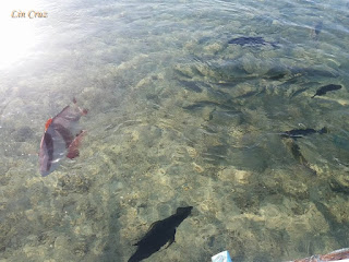
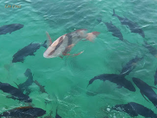
Situated in Matnog, Sorsogon and part of the island tour itinerary when going to Subic Beach and Tikling Island. Juag Lagoon is a privately owned fish sanctuary maintained by the Geneblazo family. Their native hut was built on a sandbar standing through stilts in the middle of the lagoon, which is surrounded by fish pens spread across the area. It was opened to tourists to give awareness and educate the public about preserving marine life. 

The sanctuary prides itself with crystal-clear blue waters, teeming with a wide variety of sea creatures including lobsters, coral fishes, giant clams, grouper, sea turtles and many others. Visitors can feed the fish in the sanctuary with fish pellets sold at the entrance. 

Pinoy Solo Hiker - Juag Lagoon

Pinoy Solo Hiker - Juag Lagoon

Pinoy Solo Hiker - Juag Lagoon

Pinoy Solo Hiker - Juag Lagoon

Pinoy Solo Hiker - Juag Lagoon

Pinoy Solo Hiker - Juag Lagoon

***The following pictures was shared to me by sister who went on a Sorsogon tour. Thus, it was based on her pictures and narration that this write-up was made.

Sunday, October 8, 2017

Bulusan Lake

Situated at the heart of Bulusan Volcano National Park in Sorsogon, Bulusan Lake is nestled between lush green vegetation teeming with rich flora and fauna located at the southeast flank of Mount Bulusan. The whole place offers a picturesque view with Mt. Bulusan serving as it's backdraft, thus it was dubbed as the "Switzerland of the Orient" and making it a favorite place for photo shoot. In fact, this is where Sen. Chiz Escudero and Heart Evangelista held their prenup photo shoot.

Due to it's expansive biodiversity, many locals can be seen fishing in the lake, which is about 60 ft. deep and has a circumference of 1.8km. The lake can also be explored by kayaking and aqua cycles, and there are several waterfalls, springs, and hiking trails that can be arranged if one wishes to explore the whole park at the tourism's office.

Pinoy Solo Hiker - Bulusan Lake

Pinoy Solo Hiker - Bulusan Lake

Pinoy Solo Hiker - Bulusan Lake


Pinoy Solo Hiker - Bulusan Lake

How to Get There: 
1.) From Legazpi, ride a GT Express in Tahao Road or Daraga bound for Irosin or Bulusan.
2.) Alight in Irosin junction from where you can get a trike ride to the terminal for jeepneys bound for Bulusan. 

Sunday, July 16, 2017

Ambuklao Lake (Dam)

Situated in Bokod, Benguet province, Ambuklao Lake serves as a dam for Hydroelectric facility located on the upper Agno River and its tributaries the Bokod River which is 36 km. from Baguio City. It was developed in the late 1940's for the main purpose of hydroelectric power generation, flood control and irrigation. The main source of water comes from the Agno River which originates from Mt. Data.

The rockfill dam reaches a maximum height of  423 feet above the riverbed of  the Agno River. Several structures used by the hydroelectric power plant can be seen like the gated ogee spillway and the existing power station intake which is located to the right of the embankment that is connected via the power tunnel to an underground valve chamber and power house.

Pinoy Solo Hiker - Ambuklao Lake

Pinoy Solo Hiker - Ambuklao Lake

Pinoy Solo Hiker - Ambuklao Lake

Pinoy Solo Hiker - Ambuklao Lake

Pinoy Solo Hiker - Ambuklao Lake

Pinoy Solo Hiker - Ambuklao Lake


***I joined an event organized by Traveling Adventure

Tuesday, October 11, 2016

Bass Fishing at Sierra Lake (Lumot)

Sierra Lake, also known as Lumot Lake is a man-made water reservoir located in Brgy. Lumot in Cavinti, Laguna and lies in the Sierra Madre Mountain ranges. The lake was created when Lumot Dam, an embankment dam, was constructed damming the Lumot River, creating an auxiliary water reservoir for Lake Caliraya as part of the Kalayaan Pumped-Storage Hydroelectric Plant

It is less known to the passersby who probably think it is still Caliraya Lake. In my opinion, it is more beautiful than Caliraya Lake. Like the latter, Sierra Lake is also surrounded by lush vegetation and tall trees. The water is also clearer and no trash can be found near the lake. 

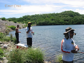
The lake is a popular watersport and fishing competition spot. Every year the LGU team organizes the watersports tournament and also Bass fishing contest. The lake is rich with fresh water fish such as Tilapia and Large Mouth Bass.Thus, one would occasionally see a group of men fishing on banks of the lake.

The place has the same altitude as Tagaytay City, but with a much cooler breeze and stronger gush of wind making it my favorite getaway during weekend. Boats for rents are available if you want to tour the lake and the nearby islets. Islands (Sundang) with cottages can also be rented for a night.

Pinoy Solo Hiker - Sierra Lake aka Lake Lumot

Pinoy Solo Hiker - Sierra Lake aka Lake Lumot

Pinoy Solo Hiker - Sierra Lake aka Lake Lumot

Pinoy Solo Hiker - Sierra Lake aka Lake Lumot

Pinoy Solo Hiker - Sierra Lake aka Lake Lumot

Pinoy Solo Hiker - Sierra Lake


How to Get There:
1. Ride a bus to Sta. Cruz, Laguna (alight in Pagsawitan).
2. Once in Pagsawitan you can ride jeepneys bound for Lumot.

Saturday, July 2, 2016

Lake Pandin


Lake Pandin is one of the lakes in the city of San Pablo that is only separated by a narrow strip of land from the it's twin crater lake which is Lake Yambo. They are part of the Seven Lakes system and are bounded by a nearby Mt. Mabilog and surrounded by Mt. Malauban. According to the tourism officer, Pandin is said to be "the most pristine" among the seven lakes with an approximate area of 20.5 hectares and a maximum depth of 63 meters.

For only 360pesos (not sure if it is still the rate after 2 years), you can ride the bamboo raft with a hefty serving of dishes (Tilapia, Shrimp, Buko Juice, Banana etc.).

Lake Pandin reminds me of the movie Lake Placid which was filmed in South America.

Pinoy Solo Hiker - Lake Pandin

Pinoy Solo Hiker - Lake Pandin

Pinoy Solo Hiker - Lake Pandin

Pinoy Solo Hiker - Lake Pandin

Pinoy Solo Hiker - Lake Pandin

Pinoy Solo Hiker - Lake Pandin

Pinoy Solo Hiker - Lake Pandin


How to Get There:

1.) Take a bus bound to Lucena (DLTB or Jac Liner), they have terminals in Cubao and LRT Buendia
2.) Tell the conductor to drop you off in San Pablo City (since, bus were not allowed inside the city you will be drop off at Mahalarlika hiway in San Pablo, you can either ride a trike or take a San Pablo bound jeepneys.
3.) Once in San Pablo, ride a jeep bound for Liliw/Nagcarlan tell the driver to drop you off in Lake Pandin (there's a big signage, and you will be required to walk 300meters to reach the lake)