Monday, March 26, 2018

Liliw Strawberry Farm (Lolo Kap's)

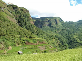
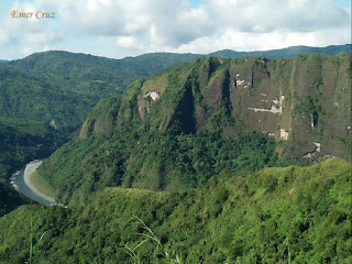
The town of Liliw, Laguna is situated beside the foot of Mt. Banahaw with an elevation of 1000ft above sea level. It is widely known as the "Tsinelas Capital" of the Philippines because of its footwear-making industry.  Today, another attraction has caught my attention which is an organic strawberry farm that was featured in several TV shows owned by Brgy. Capt. Mario Cortez of Barangay Ilayang Sungi. 

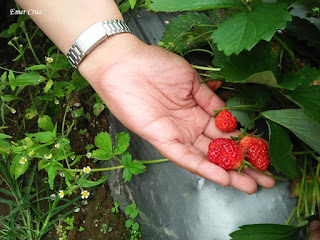
The Lolo Kap's Strawberry farm is located 4.2 km farther from the town's poblacion with a total altitude of 1960ft above sea level which has the familiar cool and soothing breeze almost similar to that of Benguet which is ideal for strawberries to thrive. It can be accessed by a narrow farm to market road. The farm is characterized by several rows of strawberry plants, sweet basil, tomatoes, broccoli and other fruit trees which also includes a coffee tree. 

Pinoy Solo Hiker - Liliw Strawberry Farm

Pinoy Solo Hiker - Liliw Strawberry Farm

Pinoy Solo Hiker - Liliw Strawberry Farm

Pinoy Solo Hiker - Liliw Strawberry Farm

Pinoy Solo Hiker - Liliw Strawberry Farm

Pinoy Solo Hiker - Liliw Strawberry Farm

How to Get There:
1. Ride a bus bound to Sta Cruz.
2. From Sta. Cruz, you can ride a jeep bound for Liliw.
** Alternatively you can go to Liliw via San Pablo City.
3. Once in Liliw Poblacion, you can flagged a trike and tell the driver that you are going to Lolo Kap's Strawberry farm (One way is 100pesos good for 2 person). 

Monday, March 19, 2018

The Battle of Tirad Pass

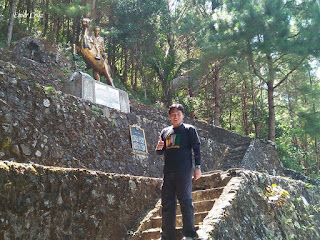
The infamous Battle of Tirad Pass was also referred by some historians as the "Philippine Thermopylae". It was a battle that was held in Northern Luzon particularly in the town of Gregorio Del Pilar, Ilocos Sur formerly known as Concepcion during the time of Philippine-American War which was fought on December 2, 1899. It involved 60 Filipino soldiers under the command of Brigadier General Gregorio del Pilar against the 500 Americans commanded by Major Peyton C. March. The main purpose was to delay the Americans from advancing and to ensure that Emilio Aguinaldo and his troops can escape from pursuers.

After more than five hours of battle, the Americans began to felt the scorching heat of the midday sun and decided to rest for a while amidst the rocks. Later that day, the search party had succeeded their task, and the Americans fell upon the rear of the outnumbered defenders, defeating them. Over the course of the battle, 52 of the 60 Filipinos were killed. Among the dead was General del Pilar, shot through the neck at the height or end of the struggle.

The American's looted Del Pilar's possessions where they stripped him bare of his military decorations, uniform, and his personal belongings, leaving him, as the eyewitness, correspondent Richard Henry Little wrote, "We carved not a line and we raised not a stone, But we left him alone with his glory". 

Del Pilar's diary with its poignant final entry, written on the night of December 1 was also recovered which says:

"The General has given me a Platoon of available men and has ordered me to defend this Pass. I am aware what a difficult task has been given me. Nevertheless, I feel that this is the most glorious moment of my life. I am doing everything for my beloved country. There is no greater sacrifice."

Del Pilar's corpse lay unburied for three days. American officer Lieutenant Dennis Quinlan, with a group of Igorots, later buried his body and left a plaque, "Gen. Gregorio del Pilar, Died December 2, 1899, Commanding Aguinaldo's Rear Guard, An Officer and a Gentleman."

In honour of Del Pilar's heroism, the Philippine Military Academy was named Fort Del Pilar and the town's name of Concepcion was changed to Gregorio del Pilar wherein a historical marker placed at the site of the battle.

Pinoy Solo Hiker - The Battle of Tirad Pass

Pinoy Solo Hiker - The Battle of Tirad Pass

Pinoy Solo Hiker - The Battle of Tirad Pass
JP Pring, Lloyd, Barry and Pot

Pinoy Solo Hiker - The Battle of Tirad Pass

Pinoy Solo Hiker - The Battle of Tirad Pass

Pinoy Solo Hiker - The Battle of Tirad Pass


***Some texts and wordings were copied from the following references:

1.) Gregg Jones (2012). Honor in the Dust: Theodore Roosevelt, War in the Philippines, and the Rise and Fall of America's Imperial Dream. Penguin Publishing Group. pp. 135–136. ISBN 978-1-101-57512-3.
2.) Joaquin, Nick. A Question of Heroes.
3.) Moorfield Storey; Marcial Primitivo Lichauco (1926), The Conquest of the Philippines by the United States, 1898–1925, G. P. Putnam's sons, p. 109
4.) Louis Freeland Post; Alice Thatcher Post; Stoughton Cooley (1899). "The Death of Gregorio Del Pilar". The Public. Louis F. Post. 2–11.
5.) Raymond Landon Bridgman (1903), Loyal traitors: a story of friendship for the Filipinos, J.H. West (Full text, from the library of the University of California)

Sunday, March 11, 2018

Subic Beach (Pink Beach)

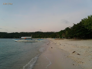
Subic Beach is situated in Matnog, Sorsogon which is located in the Southernmost tip of Luzon. It is divided into two different parts which the locals call as Subic Laki (Subic Big Beach) and Subic Liit (Subic Small Beach).

It is also known as Pink Beach because the sand gives a pinkish color when viewed from afar that is composed of fine grain, creamy white sand with the addition of crushed red coral particles which is the unique trait of the islands in Matnog. The beach is surrounded by crystal-clear aquamarine waters, it was so clear that one can easily observe the seabed sloping down from the shore, thus precaution must be observed if one wishes to take a swim.

There are several cottages that can be rented including a tent if one wishes to pitch a tent.

Pinoy Solo Hiker - Subic Beach

Pinoy Solo Hiker - Subic Beach

Pinoy Solo Hiker - Subic Beach

Pinoy Solo Hiker - Subic Beach

Pinoy Solo Hiker - Subic Beach

How to Get There:
1. Ride a bus bound to Sorsogon City (Penafrancia, DLTB and Isarog Lines)
2. Once you get to Sorsogon, ride a jeep bound to Matnog port.
3. From Matnog it is more than an hour boat ride to Tikling Island and Subic Beach etc..

Sunday, March 4, 2018

Kibungan Cross Country (KXC)

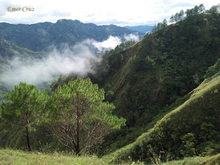
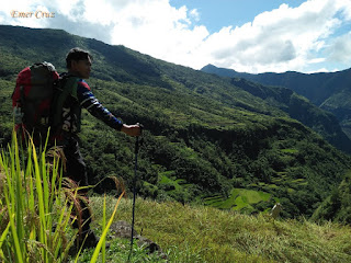
Dubbed as the “Switzerland of the Philippines”, Kibungan is located in Benguet which conveys the majestic grandeur of endless scenic landscape composed of rice terraces, rock formations, waterfalls, pine ridges, hanging bridges, occasional mossy forests and highland Kankaney villages. We did a Kibungan Cross Country simply known as KXC which starts in Benguet, passes  Ilocos Sur and ends La Union. It has an approximate distance of more or less 36km passing rolling terrains of several mountain peaks: Mt. Tagpaya, Mt. Oten, Mt. Bulalakaw, Mt. Almase, Mt. Dalipey, Mt. Batangan and Mt. Badew to name a few and some are mountain passes of nameless peaks.  

Pinoy Solo Hiker - Kibungan Cross Country

Day 1
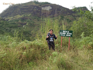
We started the trek around 10am by descending from the municipal hall of Kibungan and passing several rice paddies, it then leads to the first of the many hanging bridges on the trail. The descent is more less 600ft until reaching a gorge. From there on we started to ascend which is equivalent to the descent until reaching a plateau composed of stairs where we had our lunch. After our short break, we resumed the trek, and since then it was all about continuous ascent where we passed by scenic pine ridges composed of deep ravines making it a breathtaking experience. The trek continues, until we reached Buga Campsite (a campsite that can accommodate 10 tents), but the real campsite where we would set camp was still far ahead, thus we resumed the trek that passes through the huge wall of rock that is actually the summit of Mt. Tagpaya. The trail leading to Mt Tagpaya's summit reminds me of Mt. Kabunian's rocky trail except that there are handrails to aid the hikers in the ascent. Throughout the hike, I am the pacer of the team, and once in a while, our guide would tell me to stop and wait for the whole team. As darkness fell, it then started to rain, which made me worried because the pesky limatiks are quite active during wet season, they were frenzy and wild yet I was fortunate that not one pesky creature ever clinged to my body, but several of my teammates was a victim of the blood-sucking pest. We finally reached the bunkhouse after several hours of trekking where we set up our camp. We felt relieved but also worried that one of our teammate (Jun) was not feeling well that time, it was a good thing that Lansoy had some knowledge in herbal medicine,  thus Jun was able to regain his strength the next day.

Pinoy Solo Hiker - Kibungan Cross Country

Pinoy Solo Hiker - Kibungan Cross Country

Pinoy Solo Hiker - Kibungan Cross Country

Pinoy Solo Hiker - Kibungan Cross Country

Pinoy Solo Hiker - Kibungan Cross Country

Pinoy Solo Hiker - Kibungan Cross Country

Pinoy Solo Hiker - Kibungan Cross Country

Pinoy Solo Hiker - Kibungan Cross Country

Pinoy Solo Hiker - Kibungan Cross Country

Pinoy Solo Hiker - Kibungan Cross Country

Pinoy Solo Hiker - Kibungan Cross Country

Day 2
After having a sleepless night (it was chilling cold and I wasn't able to sleep well), we had a heavy breakfast to ensure we had the energy for the day's hike. We started the trek at around 9am and I noticed that the trail was still infested with limatiks, so I've decided to speed up the pace, me and our guide left most of the team behind because resting too much will give the limatiks the opportunity to have their way on one's body. But since there is only one guide, we stopped at some key areas to wait for the team to ensure that they can still keep up with the trail and avoid getting lost. After several hours of trekking, we reached the famed "Crying Mountains" of Kibungan, our guide told us that the waterfalls are dependent entirely on the rain. Eventhough it rained a day before it was still not enough to highlight the "Crying Mountains" epic cascade. We took some group pictures and resumed the trek passing several hills, scenic plateaus of rice terraces which overlook stone hills that is definitely a sight to behold, in simple word it was breathtaking. At around 12nn finally arrived in Batangan Elementary School where we had our lunch and took some rest. We resumed the trek towards Batangan summit which is almost a kilometer away from the school. Little did we know, we were in for a big surprise to see how steep the descent towards the village comprising of almost 80 degrees slope. As soon as we started the descent, it was an effort on our part to resist gravity from pulling us forward, or else one would continually stumble down the stairs hewn from the huge mountain wall. It was a good thing that safety railings were placed in some parts, but then again the comfort zone was far from over. Just as things were going smoothly and starting to have our momentum, it then started to have a huge downpour of rain making the trail slippery, adding another difficulty level to a notch higher. As darkness was fast approaching, I, together with Mike and Don decided to speed up the descent, we were concerned about being caught between heavy rain and darkness which makes the descent a little bit more dangerous than it already was. The whole descent was approximately 2100 ft from Batangan to the community with a slippery trail that only allows a portion of your feet to step on the next step. Ravines are present on both sides and of course, the 80 degrees slope which makes the descent painful to the knees, thus proper precaution must be observed at all times to ensure a safe descent. Finally, we at the lead group arrived just before twilight giving us a huge relief, yet we were also worried about the rest of the team that was left behind. We waited for hours under the pouring rain and after 3 hours they've finally arrived, it was such a comfort to see them safe except for some bruises, at last, the whole team was complete again just in time for dinner and socials.

Pinoy Solo Hiker - Kibungan Cross Country
Team Bulateng Bato (photo credit: Omar)

Pinoy Solo Hiker - Kibungan Cross Country

Pinoy Solo Hiker - Kibungan Cross Country

Pinoy Solo Hiker - Kibungan Cross Country

Pinoy Solo Hiker - Kibungan Cross Country

Pinoy Solo Hiker - Kibungan Cross Country

Pinoy Solo Hiker - Kibungan Cross Country
Photo Credit: Don Elmo

Pinoy Solo Hiker - Kibungan Cross Country

Pinoy Solo Hiker - Kibungan Cross Country

Pinoy Solo Hiker - Kibungan Cross Country

Pinoy Solo Hiker - Kibungan Cross Country

Pinoy Solo Hiker - Kibungan Cross Country

Day 3
It was the final day of our cross-country trek and we were so eager to hit the trail. It was mostly a descent from the community passing through a established pathway yet some portions are comprised of muddy and slippery soil, which then leads to a very slippery staircase that is comprised of more than a 1050ft descent until reaching the boundary of Ilocos and La Union. And that boundary is marked by the longest hanging bridge I've ever crossed entire life which is approximately 600 to 700 ft in length that hangs 70ft above a raging river gorge. For the first time in my entire Kibungan experience, I felt the shaking in my knees. The bridge scared the hell out of me, but I learned that no matter how scared you are, you have no other choice but to keep on going. The lead group (Mike, Don and I included) were able to keep our composure while crossing the bridge through a synchronized pace. From there on, the trail is just a series of rolling terrains among hills until reaching a river where I named it "Bulateng Bato", thus how we got the name Team Bulateng Bato and the rest is history.

All in all, our total hiking hours is about 17 hours during the 3 days trek.

Pinoy Solo Hiker - Kibungan Cross Country

Pinoy Solo Hiker - Kibungan Cross Country

Pinoy Solo Hiker - Kibungan Cross Country
One of the longest hanging bridge that i've crossed

Pinoy Solo Hiker - Kibungan Cross Country

Pinoy Solo Hiker - Kibungan Cross Country
"Bulateng Bato River"

Nosh, Mike, Jun, Omar, Edmar, Lansoy, Jay, Emer & Don Elmo

***I thank the whole Team Bulateng Bato (Nosh Mista our organizer from Adventurous People and the rest of the gang: Don Elmo, Jun Jun, Edmar, Lansoy, Omar, Jay and Mike for the tent sharing.) It was truly a memorable hike in one of the most beautiful hiking trails in the country.