Mount Natib is the highest peak in the entire Natib Caldera System situated in the Bataan Natural Park which stands at 4222ft above sea level located in the town of Orani. The mountain together with the adjacent surrounding is a protected area which was first declared as Bataan National Park in 1945.
The trail of Mt. Natib starts in the outpost in Brgy Tala which also serves as the registration for hikers. The hike commences through a cemented trail which is about 3km till reaching the viewing deck. From there on, one would enter a grassland and a very established woodland which is about 2km until reaching the fork that leads to Pasukulan Falls. The trail is continuously a forested woodland with moderate ascent for another 1.8km until reaching the foot of Mt Natib where the real challenge begins.
The final assault is characterized by a steep trail which requires technical climbing on some part with a distance of 2.1km and a 1300ft elevation gain for a total of 2300ft elevation gain and a total distance of 8.9km to reach the summit from the jump-off point. It also includes a series of 10 separate rope segments through vertical walls. Since there was a surge of Typhoon Usman when we hiked Mt Natib, the rocks were all slippery making the difficulty level a notch higher with Limatik fests everywhere, almost freezing temperature and of course zero visibility at the summit which is covered by a small patch of grassland. There are also are boulders with inscribed names of American expeditionary forces who climbed the peak way back the 1930s.
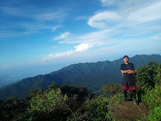
On a clear day, the summit offers a commanding view of the entire Bataan Natural Park, part of the province’s eastern and western coast, Subic Bay Freeport Zone on the northwest and a view of the entire northerly slope of Mariveles Caldera System.
On a clear day, the summit offers a commanding view of the entire Bataan Natural Park, part of the province’s eastern and western coast, Subic Bay Freeport Zone on the northwest and a view of the entire northerly slope of Mariveles Caldera System.
 |
| Mt Natib's summit on a clear day (Photo Credit: Rocky Casera) |
 |
| 1 of 10 rope segments |
 |
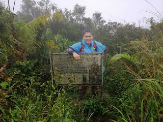
| At the summit |
 |
| Walang clearing sa summit |
 |
| The fork to Pasukulan falls |
 |
| Photo credit: Christian Vergara |
 |
| Photo Credit: Ms. Jhing |
 |
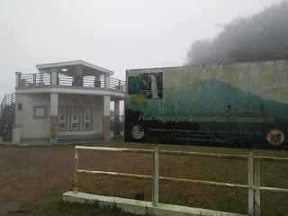
| Viewing deck |
How to Get There:
1. Ride a bus bound for Orani, Bataan
2. Tell the driver to drop you off at Orani Crossing.
3. Ride a trike bound to Brgy. Tala (Registration)
*** I joined an event organized by Rocky Casera of Rocky Outdoor
No comments:
Post a Comment