Sunday, December 27, 2020

Mt Daraitan Traverse to Tinipak River

Mt Daraitan is situated between the borders of Tanay, Rizal and General Nakar, Quezon which stands at 2300ft above sea level. This mountain offers several ecotourism and outdoor attractions such as mountains, caves, springs and limestone formations making it a gem at the heart of Sierra Madre. Mt Daraitan is also surrounded by Tinipak River which is one of the country’s cleanest, free-flowing rivers, which are then surrounded by large marble rocks that are great for bouldering.

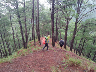
Mt Daraitan is great place to hike most especially to those who are introduced to hiking. The trail is steep but very established with a total of 1620ft altitude gain equivalent to 1.49km distance from jump off to summit, and I was able to reach the summit in 1h5m. Those who will reach the summit will be rewarded with a magnificent view of the Sierra Madre mountain range and the province of Rizal. It is also a vantage point for witnessing the sea of clouds but unfortunately we did not have the chance to witness it, yet still thankful that we had a nice clearing. The trek is usually a traverse to the "Heart Peak" which then descends to "Tinipak River" for an elevation loss of 1730ft and a total of 5.5km passing through limestones and karst formations which may become slippery during rainy season.

Pinoy Solo Hiker - Mt Daraitan
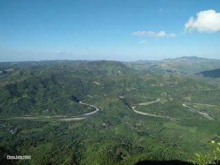
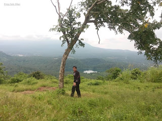
As viewed from the Heart Peak

Pinoy Solo Hiker - Mt Daraitan
The limestone formation at the summit

Pinoy Solo Hiker - Mt Daraitan
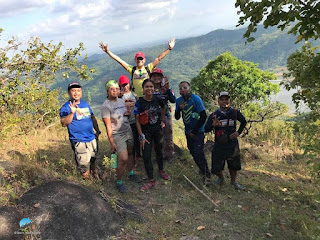
The blogger at the summit

Pinoy Solo Hiker - Mt Daraitan
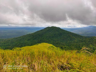
Heart Peak

Pinoy Solo Hiker - Mt Daraitan

Pinoy Solo Hiker - Mt Daraitan
Sierra Madre Mountain Range


Tinipak River offers a dramatic marble rock formations, which makes this gem a perfect getaway for the weekend. It is located in between boundaries of Barangay Daraitan in Rizal and General Nakar in Quezon Province and is considered the cleanest inland body of water in Region IV.


Pinoy Solo Hiker - Tinipak River
One of the iconic Marble/Rock formation

Pinoy Solo Hiker - Tinipak River
Ice cold water of Tinipak River

Pinoy Solo Hiker - Tinipak River
Tinipak River

Pinoy Solo Hiker - Tinipak River
Rock Formations

Pinoy Solo Hiker - Tinipak River
Marble and limestones


How to Get There:
1.) Ride a jeepney from EDSA-Shaw to Tanay, Rizal
2.) Take jeep to Sampaloc
3.) From Sampaloc, Tanay. Take tricycle to Brgy. Daraitan

Friday, August 28, 2020

San Jose Circuit (RevTrav)

Situated in San Jose, Tarlac thus the name "San Jose Circuit" refers to the three patches of mountains namely: Mt Kawayan, Bungkol Baka, and Mt Tangisan which surrounds the San Pedro Dam also known as Pangasaan Lake.

Pinoy Solo Hiker - San Jose Circuit
Pangasaan Lake as seen from Mt Tangisan's summit

The circuit trail has a total distance of 22.3km  and a combined elevation gain of 3300ft under the scorching heat of the Sun. Unlike Cawag, which still has the soothing breeze from the sea, San Jose Circuit can be compared to fellow Tarlac mountain - Mt Damas because the air is dry and relatively no breeze or any gush of wind of all sort.

I joined the event organized by Jaime Dequinon, it was almost canceled because of several scammer-joiners, good thing it still pushed through even though there are only 7 joiners left. A big shout out to Jaime and to the Akyat Mountaineer for continuing the hike and shouldering most of the expenses (we all agree to add some additional event fee to cover for the expenses). We arrived in the jump-off area at around 6am, our guides told us it was rather late if we would do a circuit traverse. They suggested the reverse-traverse trail which would start from the farthest mountain and eventually ends with the nearest mountain.

The start of the trail passes by the man-made Pangasaan Lake (San Pedro Dam), the trail then enters a forested area composts of bamboos where its name originated known as Mt Kawayan. It is composed of a gradual to moderate assault similar to that of Mt Batolusong for a total of 1600ft elevation gain for a total of 7km to reach the summit. The summit is vastly surrounded by trees and bamboos with some portion that offers as a viewing deck.

Pinoy Solo Hiker - San Jose Circuit
Pangasaan Lake which is the start of the trail

Pinoy Solo Hiker - San Jose Circuit
The start of Mt Kawayan's trail

Pinoy Solo Hiker - San Jose Circuit

Pinoy Solo Hiker - San Jose Circuit
One of the viewing deck in Mt Kawayan

The traverse to Bungkol Baka is characterized by a moderate to a steep descent with some portion comprise of loose soil for a total of 600ft until reaching an open grassland used for grazing cows. Hikers will need to navigate through overgrown "talahibs" until reaching the base of Bungkol Baka which means "Cow's hump" (guides told us it was named as such because it resembles the hump). There is a total of 700ft ascent to reach the summit of Bungkol Baka characterized by a 360-degree unobstructed view. Shout out to Sir Christian Vergara and Carmz Tan, because they have been my constant hiking buddy in the lead group during the hike and also to Reinier Alfante - photographer ko s Bungkol Baka).

Pinoy Solo Hiker - San Jose Circuit
The open grassland

Pinoy Solo Hiker - San Jose Circuit

Pinoy Solo Hiker - San Jose Circuit
"Bungkol Baka" as seen before the summit ascent

Team SJC: Roger, Reiner, Carmz, Jaime and Christian at the summit

Pinoy Solo Hiker - San Jose Circuit
Bungkol Baka's summit groupie take 2

The traverse from Bungkol Baka to Mt Tangisan is the longest part of the trail, the two summits are almost 9 km apart which includes a total descent of 1500ft. Halfway of the trail, we passed by a spring where we refilled our water containers and took our late lunch. 

Fast forward, Sir Christian, Carmz, and I throttled towards the summit of Tangisan. It was characterized by a very steep ascent overlooking the picturesque view of Pangasaan Lake for a total of 1050ft elevation gain. Flowering plants and Ornamental trees are present along the trail and I can't recall if there are pine trees (2 years ago and I have a serious issue of memory gap). 

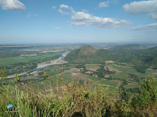
We reached the summit surrounded by huge rocks and it is characterized by an unobstructed view of the surrounding landscape that includes the three mountains from SJC, a river, Pangasaan Lake, and Mt Damas from afar. We waited for our teammates to arrive, but after almost an hour, we have decided to descend and head back to the registration. Fortunately, we met our teammates on their ascent on the way to the summit. We took another group photos and proceeded with the descend so we can clean ourselves and take a good rest and the three of us were able to finish the circuit trail in almost 9 hours.
Pinoy Solo Hiker - San Jose Circuit
As viewed from the summit

Pinoy Solo Hiker - San Jose Circuit

Pinoy Solo Hiker - San Jose Circuit
The author with Kuya Christian Vergara and Carmz Tan

Pinoy Solo Hiker - San Jose Circuit
Take 5 muna

Pinoy Solo Hiker - San Jose Circuit
We met the sweep group during our descend from the summit

Saturday, April 11, 2020

Laguna Penta

"Laguna Penta" refers to the five mountains scattered between the neighboring towns of Calauan, Nagcarlan and San Pablo namely: Prinza, Kalisungan, Atimla, Mabilog and Obabis which offers great hiking destination in Laguna aside from Mt. Makiling and Romelo. Based from my data, it has a combined elevation gain of 5800ft and an elevation loss of 5400ft for a total of 26.5km (Mt Prinza traverse to Kalisungan which includes river crossing). Otherwise, it is only 21km if you ride a van towards Kalisungan mountain base and can be finished between 12 to 16hours (the muddy trail is the key factor). 

The hike usually commences with Mt Prinza that passes a cemented road which then leads to a forested trail. Like all "Laguna Penta" mountains, the common characteristic is the muddy and slippery trail. It is short but comprised of cardiac ascent characterized by a steep trail with overgrown grass and muddy trail until reaching the viewing deck. It offers a commanding view of Mohicap Lake and Palakpakin Lake, then another fifteen minutes of the trek leads to the actual summit which is comprised of an abandoned antenna/tower for a total of 1400ft elevation gain. Traditional Laguna Penta usually does a river crossing towards the base of Kalisungan (second mountain), but most organized hikes nowadays would usually ride back to their rented vehicle towards Kalisungan which could save them at least 2 hours of hiking time.

After the river crossing, we took our breakfast before we started the ascent to Mt Kalisungan characterized by an almost perfectly-shaped conical terrain that has an elevation of  2493ft above sea level. It is composed of two parts and has a total of 2000ft elevation gain. The first part of the trail is mostly forested with slopes averaging 45 to 50 degrees. Then after more than an hour of trekking, we reached the second part of the trail which is even steeper, composed of open grassland (predominantly cogon) and loose soil with slopes until reaching Mt Kalisungan's summit characterized by a municipal border marker (San Pablo, Calauan and Nagcarlan).

The summit offers a 360 degrees unobstructed view that includes: Mt Makiling, Laguna Lake, Talim Island (Mt Tagapo), Mt Banahaw, Mt Cristobal, and even Metro Manila can be seen from afar.

After taking some pictures, we already felt the scorching heat of the Sun at 9am so we started to descend the traverse to Atimla. The trail as I would like to describe is insanely steep, very steep. It features going down through the eastern portion of Kalisungan comprising of almost 70-80 degrees inclination for about 500 ft., it is best if one would sit during the descend to maintain your center of gravity, otherwise, you would plummet down the trail. It has a total of 1020 ft total descent to reach a valley that commences the assault to Atimla. It was so steep that it was actually my first time to sit and slide down during descent with nothing else to cling on except the razor-sharp samurai grass.

Upon entering the trails of Atimla, one will be surprised that it is totally a forested woodland that is teeming with red ants, mosquitoes and a wide array of insects (It is recommended to wear long sleeves). From the valley, one has to ascend another 700ft to reach the summit which is like a jungle as seen from the Jurrasic era untouched and unexplored. It is steep with no rocks and tree branches to cling on, just pure muscle power. 

At the junction, we regrouped and had our lunch and after a while, we started the traverse towards Mt Mabilog. The trail is muddy which is sometimes knee-deep and slippery that passes through a densely forested pathway where some Horse's poop was a common sight along the trail. It has an approximate distance of about 6.2km until reaching a village where we bought some soft drinks and refilled our water. 

We then resumed our hike towards Mt Mabilog which passes through a series of coconut trees, banana fields, and fruit trees. The trail has a total distance of 3 km. with a gradual ascent and only becomes steep in the last 700 meters. It has a total elevation gain of almost 900 ft. from the jump-off point and stands at 1447 ft. above sea level. After taking pictures we have decided to descend towards Lake Pandin, it also passes Lake Yambo and we headed towards our rented vehicle in the parking lot to resume to the hike to the last part which is Mt. Obabis.

Mt Obabis has a predominantly densely forested trail, it may be short but it is a solid assault of 680ft elevation gain. It has several forks that are quite misleading or we were misled unconsciously. I thought we were following someone in the front, then we go in circles for a while, good thing that we heard barking dogs which led us to the Telecom tower at the summit and also found the rest of the team to regroup. Mt Obabis' The jump-off is also known as the "Ube Halaya" capital of Laguna and Region 4.

I would personally rate it as 7/9 difficulty hike with only one water source.


Pinoy Solo Hiker - Laguna Penta
The traverse descent to Atimla

Pinoy Solo HIker - Laguna Penta
Kuya Bino with Kalisungan at the background

Pinoy Solo HIker - Laguna Penta
Banahaw and Cristobal as viewed from Kalisungan's summit

Pinoy Solo HIker - Laguna Penta
Chris, Jordan, Amor, Kulas, Michael and Kuya Bino

Pinoy Solo HIker - Laguna Penta
Mt Imok and Prinza
Pinoy Solo HIker - Laguna Penta
Lake Mohicap and Palakpakin

Pinoy Solo HIker - Laguna Penta
Obligatory photo-op at Mt Prinza's viewing deck

Pinoy Solo HIker - Laguna Penta
Kalisungan as seen from Mabilog's traverse trail

Pinoy Solo HIker - Laguna Penta
How on Earth did it get here?


Pinoy Solo Hiker - Laguna Penta
The dense trail of Atimla

Pinoy Solo HIker - Laguna Penta
To Atimla's summit

Pinoy Solo HIker - Laguna Penta
Lake Yambo

Pinoy Solo HIker - Laguna Penta
The trail leading to Mabilog's summit

Pinoy Solo HIker - Laguna Penta
Banahaw, Cristobal and Lake Pandin as seen from Mabilog's summit

Pinoy Solo HIker - Laguna Penta
Summit pose at Mt Mabilog

Lake Pandin

Pinoy Solo HIker - Laguna Penta
Malarayat range as seen from Obabis' trail

Pinoy Solo HIker - Laguna Penta
Telco's tower at Mt Obabis' summit

***Based on my two Laguna Penta hikes, there are difficulties with regards to shower and bathe area since Obabis is the last stop. If you have a rented van I would suggest to make Prinza the last stop since there is a private pool near its jump-off.

Only Kuya Bino is the trusted guide for Laguna Penta, Brgy Lamot of Calauan only allows Mt Kalisungan hike so its best to coordinate with Kuya Bino before doing so.

Thursday, April 9, 2020

Mt. Namandiraan Traverse

Located in Ilocos Sur which is situated beside Bessang Pass in Cervantes, Mt. Namandiraan is the highest peak in the province of Ilocos Sur which stands at 7648ft above sea level. It is also the highest point where one can set a camp in the whole Ilocos Region. I asked the local tour guides regarding how this mountain got its name. According to them, Namandiraan's name may have originated from the word Bandila (flag) when the Commonwealth flag was raised in this mountain during the 1930s. This mountain also witnessed the "Battle of Bessang Pass" which is considered as one of the greatest battles won by Filipinos. 

This is one of my dream climbs because of its historical significance and of course its sheer beauty. But my first two Namadiraan climbs were canceled due to lack of joiners (most people would not join an event unless they have heard about it, otherwise it is not appealing to them). Due to diligence and persistent searching for Namandiraan's event I was able to join an outreach hike by DHAMO for "Baby Blue", and I was so thankful that it was a hike for a cause, not to mention with much affordable event fee.

Cervantes is considered as the Summer Capital of Ilocos Sur, so it's no wonder that we are already around 4980ft elevation above sea level. We arrived in Bessang Pass at around 10am, then we started our hike at 10:30am. The start of the trail is composed of a cemented pathway with a surprising 1100ft altitude gain for almost 3.5km of trek until reaching a village where we took our lunch. After we had our break, we then descended a very steep river valley for about 1200 ft. which somehow resembles Akiki trail's steepness through a myriad of Pine trees. We then reach Ballay river characterized by strong flow of water making it almost impossible to river cross and the only option was to cross through a makeshift bridge made from a fallen Pinetree which is less than a foot in diameter. Honestly, it offers no room for mistakes, otherwise, you'll end up on a stretcher.  After we have regrouped at the lead team, we started to enter and ascend a mossy forest for 2900ft elevation gain that resembles the trail that of Kalawitan and also consists of limatiks but not as aggressive compared from other mountains or so I thought it was. Together with the lead group, I was the third to arrive at 4:30pm after 6hours of trekking for a distance of 10km and a total combined elevation gain 4000ft to reach the summit. Being the first to arrive gives you the luxury to choose the best spot, so I did set my tent at my preferred spot. The summit was filled with Limatiks and unknowingly many have crept unnoticed in my bag and inside my tent. While I was asleep these little bloodsuckers had a feast, I had several bites in my face, hands, and feet I would only realized when I woke up. It rained so bad that night, we were worried that some of our groupmates were caught in the heavy downpour, it made the trail slippery and infested with Limatiks which extended their hike to 11hours, some arrived at 10pm and they later realized that they are dealing with an 8/9 difficulty, but in my opinion, Namandiraan is between 6-7/9 level of difficulty made worse by the rain.

The next morning, I was so excited to check the summit and it's surrounding view. I was honestly expecting a sea of clouds and I was dismayed at first but then I was still thankful for the clearing and the good weather that day for a chilling hike. We then started to descend, and I've decided to join the sweep since I want to know other hikers and their stories. But as the trek goes on, I was slipping past each hiker then I would later find myself with the lead group again.

The descend portion of the trail is actually more picturesque as compared to that of the ascend (regular traverse). From the summit towards Sitio Namita there is a total of 5800ft elevation loss passing through rolling terrains for peak 4 to 7 and passing a myriad of Pine forest that is composed of the final 2000ft descend for a total of 14km. The trail is simply mesmerizing, it also passes thin ridges, knee busting steep descend, rice terraces, river crossing, pine forest that are covered with moss, and of course the remarkable Kay-Ang Rock (a noticeable landmark which also serves as photo ops spot). We have also scaled a very thin knife-edge ridge composed of slippery rocks which are about a foot in diameter with vertical drops at both side.

Special mention to Chino Moreno who eventually became my hiking buddy during that time. We were able to finish the descend in less than 6hours (5h30m with multiple regroups included) towards Sitio Namita. We then hire a trike (a total of 18km) to bring us back to Bessang Pass and arrived at around 4pm. We were lucky to witness the sunset/sea of clouds unfold around Besang Pass. We at the lead group were to able hang out and do some socials at Bessang Pass. We waited for quite a while but due to injuries most of our teammates arrived at around 11:30pm. I was not able to go to work the next day because we arrived in Cubao at around 10am but it's all worth it.

Pinoy Solo Hiker - Mt Namandiraan
Mt Namandiraan's summit

Pinoy Solo Hiker - Mt Namandiraan
Kay-Ang Rock

Pinoy Solo Hiker - Mt Namandiraan
Team DHAMO's climb for a cause

Pinoy Solo Hiker - Mt Namandiraan
A splurge of Rainbow (Photo credits to Chino S. Moreno)

Pinoy Solo Hiker - Mt Namandiraan
The initial part of the trail

Pinoy Solo Hiker - Mt Namandiraan
The lead group during the ascent (James, Mike, Tin & Emer)

Pinoy Solo Hiker - Mt Namandiraan
Ballay River

Pinoy Solo Hiker - Mt Namandiraan
The log which serves as a bridge, one wrong move and you're gone.

Pinoy Solo Hiker - Mt Namandiraan
The Akiki-like descend towards Ballay River

Pinoy Solo Hiker - Mt Namandiraan
Mossy Pine Trees

Pinoy Solo Hiker - Mt Namandiraan

Pinoy Solo Hiker - Mt Namandiraan
With Ernest, Mike and Chino

Pinoy Solo Hiker - Mt Namandiraan
Rice Terraces
Pinoy Solo Hiker - Mt Namandiraan
Pine Forest during the descend

Pinoy Solo Hiker - Mt Namandiraan
Ascend towards one of Namandiraan's peak (photo credit Tinay)

Pinoy Solo Hiker - Mt Namandiraan
Mt Namandiraan as seen from Bessang Pass

***Special Thanks to Daang Hari Mountaineers (Kagawad Macoy Tayoni, Cris Escoto, Erik Aquino, Jon Ong and Demet Antonio for this Hike for a Cause event.

Salamat din sa mga hiking buddy ko: Chino Moreno, James Agud, Tin Calixtro and Mike Bonita na mga nkasabay ko sa trail.