"Laguna Penta" refers to the five mountains scattered between the neighboring towns of Calauan, Nagcarlan and San Pablo namely: Prinza, Kalisungan, Atimla, Mabilog and Obabis which offers great hiking destination in Laguna aside from Mt. Makiling and Romelo. Based from my data, it has a combined elevation gain of 5800ft and an elevation loss of 5400ft for a total of 26.5km (Mt Prinza traverse to Kalisungan which includes river crossing). Otherwise, it is only 21km if you ride a van towards Kalisungan mountain base and can be finished between 12 to 16hours (the muddy trail is the key factor).
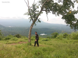
The hike usually commences with Mt Prinza that passes a cemented road which then leads to a forested trail. Like all "Laguna Penta" mountains, the common characteristic is the muddy and slippery trail. It is short but comprised of cardiac ascent characterized by a steep trail with overgrown grass and muddy trail until reaching the viewing deck. It offers a commanding view of Mohicap Lake and Palakpakin Lake, then another fifteen minutes of the trek leads to the actual summit which is comprised of an abandoned antenna/tower for a total of 1400ft elevation gain. Traditional Laguna Penta usually does a river crossing towards the base of Kalisungan (second mountain), but most organized hikes nowadays would usually ride back to their rented vehicle towards Kalisungan which could save them at least 2 hours of hiking time.
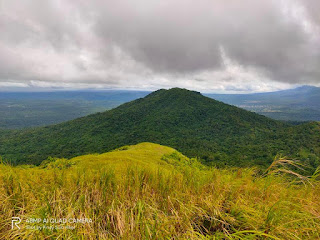
After the river crossing, we took our breakfast before we started the ascent to Mt Kalisungan characterized by an almost perfectly-shaped conical terrain that has an elevation of 2493ft above sea level. It is composed of two parts and has a total of 2000ft elevation gain. The first part of the trail is mostly forested with slopes averaging 45 to 50 degrees. Then after more than an hour of trekking, we reached the second part of the trail which is even steeper, composed of open grassland (predominantly cogon) and loose soil with slopes until reaching Mt Kalisungan's summit characterized by a municipal border marker (San Pablo, Calauan and Nagcarlan).
The summit offers a 360 degrees unobstructed view that includes: Mt Makiling, Laguna Lake, Talim Island (Mt Tagapo), Mt Banahaw, Mt Cristobal, and even Metro Manila can be seen from afar.
After taking some pictures, we already felt the scorching heat of the Sun at 9am so we started to descend the traverse to Atimla. The trail as I would like to describe is insanely steep, very steep. It features going down through the eastern portion of Kalisungan comprising of almost 70-80 degrees inclination for about 500 ft., it is best if one would sit during the descend to maintain your center of gravity, otherwise, you would plummet down the trail. It has a total of 1020 ft total descent to reach a valley that commences the assault to Atimla. It was so steep that it was actually my first time to sit and slide down during descent with nothing else to cling on except the razor-sharp samurai grass.
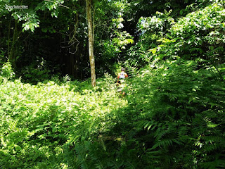
Upon entering the trails of Atimla, one will be surprised that it is totally a forested woodland that is teeming with red ants, mosquitoes and a wide array of insects (It is recommended to wear long sleeves). From the valley, one has to ascend another 700ft to reach the summit which is like a jungle as seen from the Jurrasic era untouched and unexplored. It is steep with no rocks and tree branches to cling on, just pure muscle power.
At the junction, we regrouped and had our lunch and after a while, we started the traverse towards Mt Mabilog. The trail is muddy which is sometimes knee-deep and slippery that passes through a densely forested pathway where some Horse's poop was a common sight along the trail. It has an approximate distance of about 6.2km until reaching a village where we bought some soft drinks and refilled our water.
We then resumed our hike towards Mt Mabilog which passes through a series of coconut trees, banana fields, and fruit trees. The trail has a total distance of 3 km. with a gradual ascent and only becomes steep in the last 700 meters. It has a total elevation gain of almost 900 ft. from the jump-off point and stands at 1447 ft. above sea level. After taking pictures we have decided to descend towards Lake Pandin, it also passes Lake Yambo and we headed towards our rented vehicle in the parking lot to resume to the hike to the last part which is Mt. Obabis.
Mt Obabis has a predominantly densely forested trail, it may be short but it is a solid assault of 680ft elevation gain. It has several forks that are quite misleading or we were misled unconsciously. I thought we were following someone in the front, then we go in circles for a while, good thing that we heard barking dogs which led us to the Telecom tower at the summit and also found the rest of the team to regroup. Mt Obabis' The jump-off is also known as the "Ube Halaya" capital of Laguna and Region 4.
I would personally rate it as 7/9 difficulty hike with only one water source.
 |
| The traverse descent to Atimla |
 |
| Kuya Bino with Kalisungan at the background |
 |
| Banahaw and Cristobal as viewed from Kalisungan's summit |
 |
| Chris, Jordan, Amor, Kulas, Michael and Kuya Bino |
 |
| Mt Imok and Prinza |
 |
| Lake Mohicap and Palakpakin |
 |
| Obligatory photo-op at Mt Prinza's viewing deck |
 |
| Kalisungan as seen from Mabilog's traverse trail |
 |
| How on Earth did it get here? |
 |
| The dense trail of Atimla |
 |
| To Atimla's summit |
 |
| Lake Yambo |
 |
| The trail leading to Mabilog's summit |
 |
| Banahaw, Cristobal and Lake Pandin as seen from Mabilog's summit |
 |
| Summit pose at Mt Mabilog |
 |
| Lake Pandin |
 |
| Malarayat range as seen from Obabis' trail |
 |
| Telco's tower at Mt Obabis' summit |
***Based on my two Laguna Penta hikes, there are difficulties with regards to shower and bathe area since Obabis is the last stop. If you have a rented van I would suggest to make Prinza the last stop since there is a private pool near its jump-off.
Only Kuya Bino is the trusted guide for Laguna Penta, Brgy Lamot of Calauan only allows Mt Kalisungan hike so its best to coordinate with Kuya Bino before doing so.


How to contact kuya bino?
ReplyDelete