Mt. Pinatubo is situated between the provinces of Pampanga, Zambales and Tarlac. It is considered as the beauty that rose from destruction which is one of the most famous destination in Central Luzon.
When Mt. Pinatubo erupted in 1991, it became the second largest eruption in the 20th century that causes billions of damages to properties, crops and deaths to countless lives.
My first visit to Mt Pinatubo's crater lake is via the Skyway and my second visit which I am sharing in this blog is our dayhike to Mt Pinatubo via Sapang Uwak that traverses around Pinatubo's crater rim and also traverses nearby Mt. McDonald.
Based on my Strava recording, Pinatubo via Sapang Uwak or Delta V has a total trail distance of 46.2km, if you ride a "habal-habal" it means you only hike 38.5km.
From the registration center the trail starts with a cemented/rough road with a gradual to moderate ascend until reaching the junction for a total of 1000ft elevation gain. From there on, one will descend a very steep forested pathway composed of loosed sand/ashes for a total of 1100 ft which then leads to a river bank that signifies the start of river crossing in Sapang Uwak.
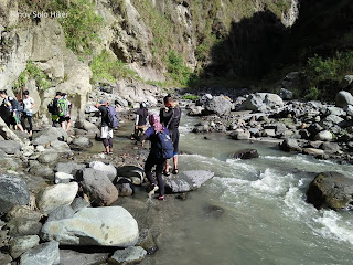
"Sapang Uwak" is actually part of the Pasig Potrero river, and during the lahar flooding in the early 90's, the Army set a watch point in the river whose company are called Delta V. Traversing Sapang Uwak is quite an adventure itself which also requires river trekking which at some point the current are quite treacherous most especially during heavy rain. There are also some portions that requires bouldering among huge rocks.
Sapang Uwak
Further river trekking would lead to Apo Mallari falls which signals the end of the river trekking. Apo Mallari Falls is actually 12.5km from the jump off point.
Apo Mallari Falls
From the falls, the trail that then leads to Pinatubo's crater rim is moderate hike that passes through huge rocks which also requires bouldering and technical climbing on two vertical walls (10 and 15ft). When you have reached the crater rim it means you have hiked a total distance of 25km from the jump-off with a total of 3600 ft elevation gain. The Sapang Uwak trail would lead you around the crater rim composed of loose ashes/sand which at some point may collapse and cause landslide.
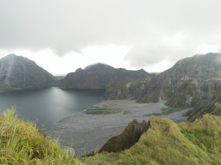
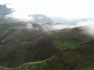
It offers unobstructed view of Mt Pinatubo's crater including, the nearby Mt Mcdo and the other unnamed mountains in the nearby terrain.
Mt Pinatubo Crater Rim
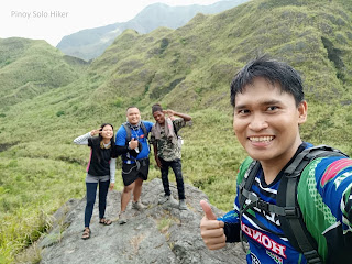 |
| With Jem Paz and Kuya guide |
We took some pictures and rest for a few minutes then decided to proceed with the hike. It started to rain pretty hard when we descended Mt Pinatubo for a total of 700 ft until we reached a valley. From there on, our guide told us that we need to ascend a vertical wall of around 900ft in order to reach Mt. McDonald's summit. It was raining and the trail/stones were quite slippery and it requires great focus because the ascent requires technical climbing. The summit of Mt McDo marks the 27th km of the trail.
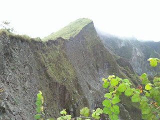
Mt McDo's summit is like a huge plateau which is actually called a helipad. The summit itself is characterized by a 360 degrees picturesque view of nearby Mt. Negron, Mt Pinatubo's summit crater, hills, and unnamed peaks.
We waited and regrouped in the summit for more than an hour. Furthermore, the guide told us that the Zombie trail during the descend is actually confusing and tiring, thus hiking as a group is greatly encouraged.
Mt McDo
The start of the Zombie trail would enter a grassland composed of overgrown "Talahibs", it has a total of 12km which also passes a forested trail that seems to be endless and at some portion creepy until reaching the junction which marks end of the trail. It is also the start of the established road which means you have hiked a total of 38.5km.
There are options to ride a habal-habal or proceed with the hike, I chose to proceed with the hike together with Michael, Ate Angel, Kuya Jeh, Jordan and Joshua to complete the full 46.2km of Pinatubo via Sapang Uwak.





No comments:
Post a Comment