Monday, March 11, 2019

Mt Kabunian

This blog post was already more than a year overdue, but now I just had the time to write our Mt. Kabunian hike which happened last December of 2017, so here it goes.

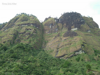
Mt Kabunian is part of the Bakun Trio mountains which is popularly known as the "home of the kankana-ey god, Kabunian." According to a local legend, "Kabunian", the legendary head of the gods always left golden plates of meat and rice on the trail to feed the tired and hungry people scaling the mountain. Duligen, who has been a recipient of this kindness, stole some plates, which he surmised would command a handsome price in the market. But Kabunian learned about his evil intention. Out of anger, the chief god embedded him on a rock and only had Duligen's now monstrously large phallus protrude as a reminder that evil never wins.

Some parts of the huge rocky mountainsides were used as a burial grounds, hence the presence of box coffins with human bones can be seen in some parts of the trail. Mt. Kabunian may not be that high but the trail can pose a great challenge to beginners most especially to those with serious acrophobia. With all honesty, it's one of the most dangerous trails I've ever been to. In fact, three of our colleague in the hike aborted the climb haft way through considering that they were all experienced hikers. 

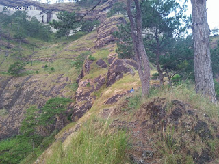
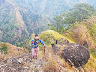
The trail has a total distance of 7km from Poblacion to the summit (14km for backtrail). The hike starts with a 900ft descent to a flight of cemented stairs which then leads to a gorge. It signifies the gradual ascent passing through stairs hewn from a rocky portion of a mountainside with some safety railings placed to aid the hikers during ascend and descend since most part is a ravine. Upon further hiking, one will reach a rocky portion with loose rocks, and one can only imagine how perilous the trail can be during rainy days. From there on, one will pass a very narrow mountainside trail which is actually less than a foot in width composed of loose rocks and soil with nothing to cling on. It was just pure guts to cross this route because one wrong move and you'll be hurtling down the mountain. Then comes the stairs hewn from the rocks which are very steep, thus safety railings were also placed to help the hikers which are approximately 200ft ascend where it features steep cliffs and rock drop-offs. It then leads to a hanging bridge that leads to the final 500ft steep assault to the summit that passes rocky mountainside trail for a total of 2400ft elevation gain from the jump-off point. Throughout our hike, there was a strong gushed of winds that were constantly challenging our every step which was comparable to 80km per hour (It was both scary and creepy as if the winds were mystical in origin. It miraculously stopped when decided to descend from the summit).
Pinoy Solo Hiker - Mt Kabunian
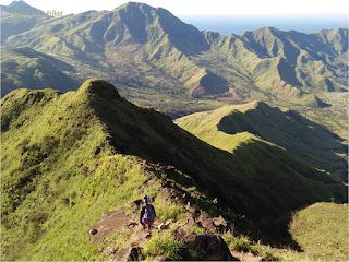
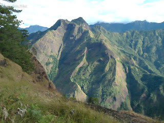
The very scenic trail

Pinoy Solo Hiker - Mt Kabunian
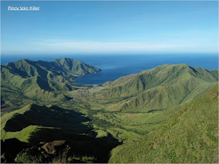
The summit at the other side 

Pinoy Solo Hiker - Mt Kabunian
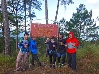
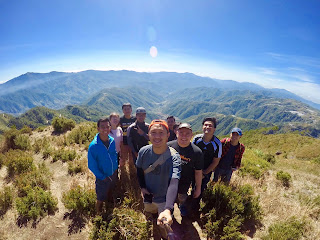
Team Una ng LAQBAI at the summit (Photo credit: Ron Dubois)

Pinoy Solo Hiker - Mt Kabunian
The final 500ft assault to the summit


Pinoy Solo Hiker - Mt Kabunian
The short hanging bridge before the final assault

Pinoy Solo Hiker - Mt Kabunian
Photo credit: Ron Dubois

Pinoy Solo Hiker - Mt Kabunian
The perilous trail which is less than a foot wide

Pinoy Solo Hiker - Mt Kabunian

Pinoy Solo Hiker - Mt Kabunian

Pinoy Solo Hiker - Mt Kabunian
The descent going back to jop (Photo Credit: Kiko San Luis)

Pinoy Solo Hiker - Mt Kabunian
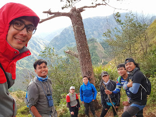
Groupie muna s trail  (Photo credit: Kiko San Luis)

Pinoy Solo Hiker - Mt Kabunian
#GwapoBeLike (Photo Credit: Ron Dubois)

Pinoy Solo Hiker - Mt Kabunian
@The summit: Emer, TenTen, Erwin, Ron & Kiko

Hike date: Dec 15, 2017
***Special thanks sa mga nakasama ko sa hike na ito: Sir Emil, Mam Rita, Ate Bing, Mommy Daisy, Ten-Ten, Erwin, Reigner, Kiko and Ron Dubois and the rest of LAQBAI.
Tuesday, February 26, 2019

Aling Taleng's Halo-Halo

One of the most sought after "Halo-Halo" in Pagsanjan and even in the whole Laguna, Aling Taleng's Halo-Halo has been in the business since 1933. 

Unique as it seems, instead of using "leche plan" and "ice cream" as their topping, they use sweetened "kundol" instead. They also use other ingredients such as white and red beans, macapuno, ube halaya (purple yum), and some preserved fruits mixed in crushed ice and of course with a generous mix of evaporated milk which made it popular among locals and foreign tourists alike.

They also serve various Filipino dishes like "Puto Bumbong" as their other specialty. Their short orders for lunch and dinner are a little bit pricey with little amount of serving and no distinct taste to make it special. I can recommend them for "Halo-Halo", but for the other food on their menu, that is a different story.

On the otherhand, the place is a little bit cozy with dim lighting. The ambiance is nostalgic because of the paintings and pictures that are displayed on the wall. 

Pinoy Solo Hiker - Aling Taleng's Halo-Halo

Pinoy Solo Hiker - Aling Taleng's Halo-Halo

Pinoy Solo Hiker - Aling Taleng's Halo-Halo

Pinoy Solo Hiker - Aling Taleng's Halo-Halo

Pinoy Solo Hiker - Aling Taleng's Halo-Halo

Pinoy Solo Hiker - Aling Taleng's Halo-Halo

Pinoy Solo Hiker - Aling Taleng's Halo-Halo

Address: 169 General Luna Street, Pagsanjan

Thursday, February 14, 2019

Fantasy World

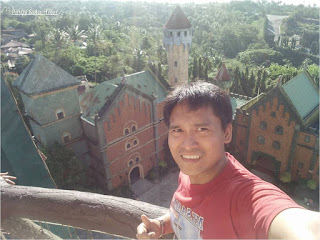
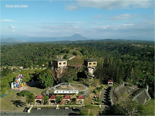
Fantasy World was an unfinished theme park located in Lemery, Batangas. The location was so ideal for medieval inspired theme wherein a castle sits atop a hill that overlooks greenland pastures and ridges. It was built with colorful walls which perfectly blend to the surrounding greenery. The stalwart structure seems to transport you back in the middle ages, it was definitely grand and could have been the Disneyland of the Philippines. But due to bankruptcy and lack of funds, the construction was halted, and to this day it still remained a fantasy.

The once colorful facade are slowly fading. Interior paint are slowly peeling from the walls of its unfinished rooms. The rides which were never used, lays dormant to this day with no hope of moving even it's first journey.

Eventhough the themed park never became operational, one can still enjoy explore and take pictures inside the whole place. Over the years, it has also become a favorite shooting place for TV shows like Majika (GMA7) and movies like Got to Believe and Fantastica. 

Pinoy Solo Hiker - Fantasy World

Pinoy Solo Hiker - Fantasy World

Pinoy Solo Hiker - Fantasy World

Pinoy Solo Hiker - Fantasy World
Mt Maculot can be seen from afar

Pinoy Solo Hiker - Fantasy World

Pinoy Solo Hiker - Fantasy World

Pinoy Solo Hiker - Fantasy World
Photo Credits: Amor Cabasan

Pinoy Solo Hiker - Fantasy World
Photo Credits: Amor Cabasan

How to Get There:
1. From LRT-Buendia ride a bus bound for Nasugbu. Tell the conductor to drop you off at the “Boundary.” It refers to the Cavite-Batangas boundary.
2. At the boundary, ride a jeepney bound for Lemery and tell the driver to drop you off in front of Fantasy World. If there are no jeepneys, you can take a tricycle.

***I joined an event organized by John Sarco which is part of our hike to Taal via Tabaro trail.

Monday, February 4, 2019

Mt Balingkilat Revisited

I've been to Mt. Balingkilat on three occasions, the first was the traverse to Nasasa Cove during the onset of Typhoon Marce way back last 2016. My second and third visit was both part of Cawag Hexa dayhike in 2018. My first ascent to the summit took 3h15m, and as I became more comfortable with the trail, I have also progressed the time to reach the summit with 3h5m on my second and 2h50m on my third time, all of which where I was part of the lead group.  

Mt Balingkilat is one of the highest peaks in the Zambales coastal mountain ranges and coves area which stands at an altitude of 3600 ft. above sea level and it is also among my top ten favorites because of the scenic view that it offers. Back in the days, American naval servicemen who served in Subic Naval Base used to call it as the “Pointed Peak” but the indigenous people (Aetas) prefer to call it as Mt. Balingkilat which means "Mountain of Thunder" for the reason that most of the time the summit is engulfed in clouds with ravaging thunder storms.

The first part of the trail is composed of grassland (overgrown "Talahib" and "Cogon" grass are present throughout the trail). After an hour of trek one will reach the only tree in the midst of the grassland which marks the start of the assault. The assault trail is more or less 2500 feet in altitude gain which has a lesser grass and is predominantly a rocky portion. It becomes very steep in the final 600 feet before the summit where it requires technical climbing skills through rock walls and boulders with almost 90 degrees vertical climb for a total distance of 7.4km. from the jump off point to the summit and a total altitude gain of 3100ft to reach the summit.

The summit offers  360 degree picturesque view of Zambales mountain ranges: Mt. Cinco Pincos and coves: Anawangin, Talesayen, Nagsasa, and Silanguin Cove. Mountains in Bataan can also be seen from afar:  Mt. Natib, Mt. Samat and Mt. Mariveles. And since most of the summit and majority of Balingkilat is a grassland, you can expect that is a blazing inferno and almost no trees to protect the hikers from the scorching heat of the sun. But compared to San Jose Circuit hike, Cawag mountains still has the soothing breeze from West Philippine Sea which makes it somehow cooler but still hellish.

Mt Balingkilat is usually hiked with a traverse to Nagsasa Cove or a traverse to the other mountains in the Zambales Coastal which includes Mt Nagsasa (Bira-Bira), Cinco Picos, Dayungan, Naulaw and Redondo for a complete Cawag Hexa. For both trails one has to descend a total of 1950ft through rocky ridges and steep knife edges before passing a portion of Mt Nagsasa.

Pinoy Solo Hiker - Mt Balingkilat

Pinoy Solo Hiker - Mt Balingkilat
Nagsasa Cove

With Ate Lorna, Noemi, Manuel, Alano & Arvin

With Akyat Tanaw Mountaineers: Jaime & Vincent

Photo credits to Arvin


The traverse descend to Bira-Bira

How to Get There:
1. Ride a bus bound to Iba, Zambales (Victory Liner) and tell the conductor to drop you off in PNP Station of Subic. You also need to prepare a letter of intent before you can start your hike which will be submitted to PNP Subic.
2. Then ride tricycle going to Sitio Cawag, Mt. Nagsasa's jump off point.

*I joined an event organized by Jaime Dequinon of Akyat Tanaw Mountaineers
**I recommend Kuya Joel Soria as a local guide for Cawag mountains (Balingkilat, Nagsasa, Cinco Picos).

Wednesday, January 23, 2019

Sip & Gogh

Last April we had our team's engagement activity in Sip & Gogh. At first, I never taught that I would enjoy that activity since I don't have any artistic talent in me, how wrong I was. 

Sip & Gogh is the first-of-its-kind paint and sip studio in the country which started last 2012. It is a perfect place to be with family and friends to socialize, explore hidden talent and enjoy time painting together.. 

For 1000 pesos you will be able to do an artwork while sipping wine or drink the beverage of your choice with some pica-pica cheese, grapes, and crackers. Everything that you need is provided which includes: canvas, paints, brushes, palette, easel, and apron. All you have to do is unleash your artistic side, enthusiasm and of course your creativity. You can also take home your own artwork, so better turn it into a masterpiece (If I only knew earlier, mas mganda sana ginawa ko hehe).

I thank all my teammates in Team Digital and Analytics for this great engagement, and for all the staff who were very kind and attentive in guiding me during the session.

Pinoy Solo Hiker - Sip and Gogh

Pinoy Solo Hiker - Sip and Gogh
Team Digital Marketing & Analytics

Pinoy Solo Hiker - Sip and Gogh
The master preparing for his masterpiece

Pinoy Solo Hiker - Sip and Gogh
My simple painting (Cawag Hexa)

Pinoy Solo Hiker - Sip and Gogh
Sample artwork that you can copy

Pinoy Solo Hiker - Sip and Gogh

Pinoy Solo Hiker - Sip and Gogh
Tapos na kmi sa aming mga artwork

Pinoy Solo Hiker - Sip and Gogh

For more details, feel free to check their website https://www.sipandgogh.com/ 

Wednesday, January 16, 2019

Mt Timbak Revisited

I have visited Mt Timbak also known as Mt Singakalsa on two occasions. My first visit was a complete disappointment due to the torrential rains that was brought about by a typhoon that gave the surrounding view a zero visibility, shrouded in fog. Then my recent visit was the exact opposite where I had the chance to witness the 360 surrounding view atop Luzon's third highest peak, something Mt Timbak can proudly offer.

This is definitely one of the easiest hikes among the top 10 highest mountains in the Philippines. It ranks as the third highest peak in Luzon and ninth overall in the country which stands at 8,914ft above sea level.

It is also one of the most accessible mountains in the Cordillera that can be accessed from the Halsema Highway which is the highest road in the Philippines via a public vehicle. But if you have a rented vehicle like our Timbak event where the whole group decided to let the van drove all the way to the school (except for me, I wanted to start from the highway). Trekking time can be lessened by at least an hour if the trek starts in Mangoto Elementary School which also translates to almost 1000ft elevation difference. From there on, one can reach the summit in almost 15 to 20mins depending upon one's pacing which is equal to 505ft altitude gain. 

The trail which leads to the summit is composed of a cemented pathway which then leads to vegetable terraces where the locals grow carrots, cabbage, potatoes, and different flowers as well. This is also considered the highest place in the country where the locals reside near the summit. Mt. Timbak offers one of the most stunning views of the sunset and it offers a 360-degree view of the surrounding landscape which includes Pulag, Ugo, and the Halsema Highway and a chance of Sea of Clouds.

Pinoy Solo Hiker - Mt Timbak

Pinoy Solo Hiker - Mt Timbak
Mt Timbak as seen from the highest Hi-Way in Halsema

Pinoy Solo Hiker - Mt Timbak
The blogger at summit's grotto

Pinoy Solo Hiker - Mt Timbak
Team Buwang (Photo Credit: James Berwin Aluning)

Pinoy Solo Hiker - Mt Timbak

Pinoy Solo Hiker - Mt Timbak
Mt Pulag's Sea of Clouds

Pinoy Solo Hiker - Mt Timbak

Pinoy Solo Hiker - Mt Timbak

Pinoy Solo Hiker - Mt Timbak
Vegetable Terraces

Pinoy Solo Hiker - Mt Timbak
Halsema Highway 
How to Get There;
1. From Baguio City, ride a bus bound for Sagada or Bontoc
2. Alight in KM. 55 (tell the conductor you are going to Mt Timbak (left side, there is a big signage)
3. Once you arrived in Timbak Elementary School, just ask the locals for directions.
4. Be careful not to trample over vegetables, please be courteous when passing by, ask permission first.

***I joined an event organized by Sabin Montero and Team Buwang which is part of our Luzon 3-2 hike that includes Mt Tabayoc and the 4 Mystical Lakes of Kabayan.