Tuesday, January 16, 2018

Bakun Trio

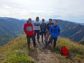
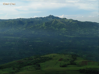
One of the hidden gems in the Cordillera region, "Bakun Trio" refers to the three mesmerizing mountains which are situated in the town of Bakun, Benguet and envelopes the Poblacion that also serves as the jump-off point for the three.

Each mountain has a distinct characteristic, trail class, surrounding view and level of difficulty. It is composed of Mt. Lubo which is the highest among the three and is also the easiest to climb. Mt. Tenglawan has the longest trail to reach the summit with it's famous "Carrot Peak", it also have Limatiks in some parts of the trail.  And last but not the least is Mt. Kabunian which is believed to be the home of god "Kabunyan" and for me, this is the most challenging among the three. It requires some serious rock scrambling that resembles "Batangan" of Kibungan making it not suitable for the faint-hearted.

I will blog my detailed write-up for Tenglawan, Kabunian and Lubo next month.

Pinoy Solo Hiker - Bakun Trio

Pinoy Solo Hiker - Bakun Trio

Pinoy Solo Hiker - Bakun Trio

Pinoy Solo Hiker - Bakun Trio

Pinoy Solo Hiker - Bakun Trio

Pinoy Solo Hiker - Bakun Trio

Pinoy Solo Hiker - Bakun Trio

Photo Credits:  Ron Rondubio and Kiko San Luis
***I joined an event organized by Emil Gannod of Laqbai
Monday, January 8, 2018

Naambon Falls

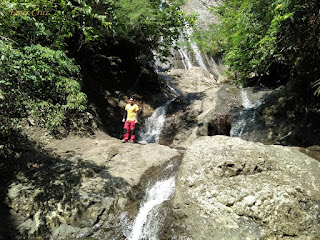
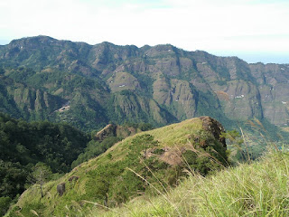
My visit to Naambon Falls was a side-trip from Team Una's: "Summit to Sea" event from the nearby Mt. Daguldol which is located in San Juan, Batangas. I was surprised to know that it is a hidden gem consists of more than a 120 ft. cascade composed of 3 tiered drop through rocks and boulders that feeds a small catch basin. 

The trail that leads to the falls includes a 400 ft. descent from Mt. Daguldol's trail (turn right) where one has to pass through a forested and slippery trail for approximately 30 minutes. From there on, one will reach a stream and a series of boulders which then leads to "Naambon Falls". According to the locals, during summer the falls has hardly any water, thus it was named "Naambon" because the drop during that season is comparable to a drizzle.

Pinoy Solo Hiker - Naambon Falls

Pinoy Solo Hiker - Naambon Falls

Pinoy Solo Hiker - Naambon Falls

Pinoy Solo Hiker - Naambon Falls

Pinoy Solo Hiker - Naambon Falls

Pinoy Solo Hiker - Naambon Falls

***Naambon Falls is actually part of  Team Una's Summit to Sea event which also includes Mt. Daguldol hike and swimming in San Juan Beach.

Monday, January 1, 2018

Mt. Talamitan

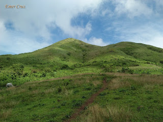
Named after the "Talamitan" trees that used to grow in it's mountain slopes. Mt. Talamitan is believed to be a dormant volcano and is usually hike together with the neighboring Mt.Apayang for a twin hike. The first part of the trail passes through a woodland which then passes an open field for grazing cows and goats. Then the last part of the trail is consists of lush grassy fields composed of cogon trails consisting of at least 300 ft. assault to reach the summit.

It has an altitude of 2040 feet above sea level with almost 1400 ft. altitude gain from the jump off to the summit. Considered to be an easy hike which is perfect for beginners but then again, hikers are still encouraged to be cautious as some parts of the trail are steep (almost 60 degrees) and becomes slippery during rainy season. Thus, precaution must be observed at all times.

Since there are no trees present along the mountain trail, one will have to deal with the scorching heat of the sun. It also lacks the cool breeze and strong gushed of wind compared to Mt Batulao, thus it is quite exhausting most especially during the summer season. Nonetheless, the view from the summit is 360 degrees panoramic view of Batangas and Cavite, making it one of the best scenic view near the Metro.

Pinoy Solo Hiker - Mt. Talamitan

Pinoy Solo Hiker - Mt. Talamitan

Pinoy Solo Hiker - Mt. Talamitan

Pinoy Solo Hiker - Mt. Talamitan

Pinoy Solo Hiker - Mt. Talamitan

Pinoy Solo Hiker - Mt. Talamitan

How to Get There:
1. Ride a bus bound for Nasugbu, Batangas.
2. Alight in Km. 83 (Brgy. Aga) which is the jump off/registration area.
3. Secure a guide.

***I've visited Mt. Talamitan twice, the first one was a solo hike and my second hike were I joined an event organized by Mark Anthony Odang of Manlalakbay Mountaineers.

Guide: Haries Yu 09360245124

Friday, December 29, 2017

Tikling Island

Named as "Tikling" island, because numerous birds such as Buff-Banded Rail (Gallirallus philippensis) or "Tikling" in Tagalog were abundant in the past. It may not be as popular as Boracay but it's beauty is mesmerizing, making it one of the beaches that offers a picturesque view of the tides hitting the shores composed of lush vegetation which is deserving to be labeled as a tropical paradise. It is more than an hour boat ride from Matnog in Sorsogon which is located at the southernmost tip of Luzon.

The beach is composed of fine grain, creamy white sand with some crushed red coral particles, giving  it a pinkish color when viewed from afar. The island is surrounded by crystal-clear aquamarine waters and composed of vegetation mostly coconut and other tropical trees in thick clusters.

Tikling Island is a privately-owned property, there are no cottages or huts for rent, but day tour are allowed and surprisingly there are no entrance fees that are collected. 

Pinoy Solo HIker - Tikling Island

Pinoy Solo HIker - Tikling Island

Pinoy Solo HIker - Tikling Island


Pinoy Solo HIker - Tikling Island

How to Get There:
1. Ride a bus bound to Sorsogon City (Penafrancia, DLTB and Isarog Lines)
2. Once you get to Sorsogon, ride a jeep bound to Matnog port.
3. From Matnog it is more than an hour boat ride to Tikling Island.

Friday, December 22, 2017

Luk Yuen

Like any other noodle house, Luk Yuen started from it's modest beginning in 1981 and has grown into a household name with it's favored specialties of congee, noodles, dimsum and other Chinese food. The restaurant is a little bit cramped with a little space to spare, but it is clean and always packed with people because of it's affordability and of course it's superb taste.

One of the must-try is their Hainanese chicken dish which is savored with their signature sauce from the meat to the rice which are both seasoned well. Noodle Feast, is also a household specialty  which is richly garnished with beef, pork, seafood, and the noodle that is perfectly cooked.

We ordered a set of meal which was served pretty fast, making it a reliable pit stop for the family especially for it's efficient service and price.

Pinoy Solo Hiker - Luk Yuen

Pinoy Solo Hiker - Luk Yuen

Pinoy Solo Hiker - Luk Yuen

Pinoy Solo Hiker - Luk Yuen

Pinoy Solo Hiker - Luk Yuen

Pinoy Solo Hiker - Luk Yuen

Pinoy Solo Hiker - Luk Yuen

Pinoy Solo Hiker - Luk Yuen

Food Rating: 7/9

Sunday, December 10, 2017

Kape-An sa Mt. Kalugong

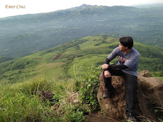
As a traveler, I cay say that "Kape-An sa Kalugong" is definitely the best way to enjoy a cup coffee when in La Trinidad, Benguet. The view is quite stunning composed of a 270-degree scenic view of La Trinidad Valley consisting of different rock formations composed of karst and limestone similar to that from Coron, Palawan. "Mt. Kalugong" which means "hat" in Ilocano is an eco park with lodges and of course a coffee shop atop a mountain with almost 400 ft. ascent from the main road. 

They brew their own coffee beans (Benguet Arabica coffee) and serve one of the best tasting cakes in the region and of course their coffee is at par with famous coffee brands. They also serve traditional food like "Pinikpikan" (chicken that is prepared in traditional way) and Kini-Ing or smoked pork.

Pinoy Solo Hiker - Kape An sa Kalugong

Pinoy Solo Hiker - Kape An sa Kalugong

Pinoy Solo Hiker - Kape An sa Kalugong

Pinoy Solo Hiker - Kape An sa Kalugong

Pinoy Solo Hiker - Kape An sa Kalugong

Pinoy Solo Hiker - Kape An sa Kalugong

How to Get There:
1. From Baguio ride a jeep bound for Camp Dangwa/Tomay.
2. Tell the driver to drop you off to Mt. Kalugong.
*** I joined John Sarco's event together with the Rock Jockers.

Wednesday, November 15, 2017

Layong Bilog (Bato)


A nice side trip after a dayhike from Talamitan and Apayang which are both located in Nasugbu, Batangas. "Layong Bato" is also known as "Layong Bilog" which offers a refreshing water where one can cool down and take a splash. According to the locals "Layon" means lagoon and "Bilog" means round which literally means "Rounded Lagoon". It is characterized by a deep and wide portion of the Galo River surrounded by numerous rock formations along the riverbanks, no wonder it is also known  as "Layong Bato".

From the summit of Mt. Talamitan one has to descend about an hour to reach Layong Bilog that passes a forested trail until reaching a rocky portion where one has to maneuver through rocks which are slippery at times. The area has also become a favorite site for rappelling a 30 meter cliff.

Pinoy Solo Hiker - Layong Bilog

Pinoy Solo Hiker - Layong Bilog

Pinoy Solo Hiker - Layong Bilog

Pinoy Solo Hiker - Layong Bilog

Pinoy Solo Hiker - Layong Bilog


How To Get There: 

1.) Ride a bus bound to Nasugbu, Batangas. Tell the conductor to drop you off in Sitio Bayabasan or Km. 83.
2.) Register at the Barangay, it is customary to get a guide, but if you already hike Mt. Talamitan before tell them you are already familiar with the trail, otherwise go get one.