Located in Camarines Sur, Mt Asog was named after a Datu chieftain of the Agtas tribe called Asog. Also known as Mt Iriga which has become a prominent landmark of the said city. It is a stratovolcano of about a kilometer from Lake Buhi which stands at 3,924ft and a base diameter of 10 kilometers.
There are several trails that leads to the different peaks of Mt Asog. We hiked via the Sitio Ilian trail which is considered as the shortest and the most recommended for dayhikers since we went on a DIY KKB through a public transportation. There is another trail called the Esplana trail which starts from Cabatuan, Buhi and requires around one to two days to reach the summit.
The trail from Sitio Ilian starts by passing through a series of coconut trees, and other fruit bearing trees which is moderately forested with gradual ascent until reaching Mt Asog's base. From there on, the trail becomes densely forested composed of ferns which also include mossy forest at some portions. The trail is mostly straight forward, enveloped with dense cogon grass for a total of 3360ft elevation from the jump-off to the crater summit.
The hike is relatively short which is only 5.6km to reach the summit in comparison to its elevation gain. It only means that the trail is purely cardiac trail with full assault comprised of some portions between 45 and 60 degrees that resembles Pantingan trail except that there are no Limatiks in the area.
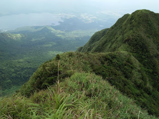
Mt. Asog's summit has a 360 degrees unobstructed view comprised of Mt Asog's broken caldera, Mt Isarog, Mt Malinao, Lake Bato, Lake Buhi and Mt Mayon can be seen from afar.
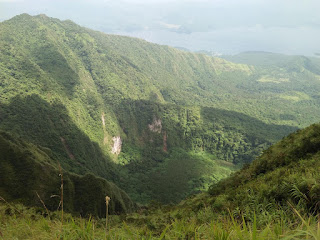 |
| View from the summit |
 |
| The blogger strikes a pose |
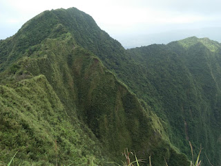 |
| One of Mt Asog's summit peak |
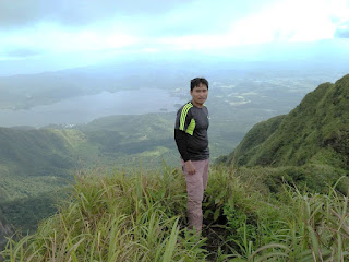 |
| Master Pogi |
 |
| Lake Buhi |
 |
| Commanding view of Iriga City |
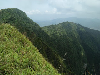 |
| Mt Asog's crater |
 |
| Mossy Forest |
 |
| Ferns throughout the trail |
How to Get There:
1. Book a bus ticket bound to Iriga City (Philtranco)
2. Ride a trike towards to Brgy San Nicolas (register)
3. You will then proceed to Sitio Ilian
No comments:
Post a Comment