It was almost three years since we had our dayhike at Mt. Isarog which is considered as the second highest peak in Bicol region next to Mt Mayon and it stands at 6450ft above sea level.
Mt Isarog is considered as South Luzon’s highest forested peak teeming with flora & fauna, rich biodiversity that includes the endemic species of Mt. Isarog Shrew Mouse, Isarog Striped Shrew Rat, the Isarog Shrew Rat and the Isolated Forest Frog.
Six municipalities and a city namely: Calabanga, Tinambac, Ocampo, Tigaon, Goa, Pili, and Naga City have territorial jurisdiction, thus there are 5 trail which leads to the summit each with different peak around the crater rim.
We took the Panicuason trail which is located in Naga City. The trail starts at DENR station which also has a fork that leads to Malabsay Falls characterized by crystal clear water and large catch basin ideal for swimming (I was the only one in our group to visit Malabsay Falls since I was the first to descend early). From the ranger station until the summit it has a total of 4790ft elevation gain so you can just imagine the trail which is pretty underrated for a 5/9 rating.
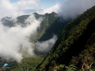
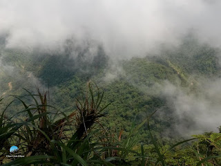
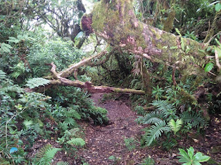
There are several campsites until reaching the summit which is near Camp 6. The trail is composed of densely forested jungle and surrounded by thick mossy forest. Trail class is between 1-4 which involves some technical climbing from moderate to full assault. Somehow, trail is comparable to Napulauan except that Mt Isarog is much denser with higher elevation gain and with the abundance in water source. I was the consistent pacer at the lead group and I was able to reach the summit in less than 5 hours. Unfortunately, there is no clearing when I arrived, I actually had a creepy feeling alone at summit surrounded by fog, nothing with darkness. Then after an hour of waiting my teammates started to arrive individually and fortunately we had a clearing by then. At the summit we have a glimpse Mt Isarog’s crater with some sea of clouds partially covering it. On a clear day, our guide told us that a distant Mt. Mayon with its perfect cone can be seen from the south, Bicol peninsula bounded by a vast waters and of course the province of Camarines Sur.
We took our lunch, and after an hour decided to descend back to the jump off. It was already 2pm and our guide told us that we might not be able to visit the falls but I descended as fast as I could and I was able to reach Malabsay falls in less than 3hours descent at around 4:45pm just in time before it gets dark.
 |
| View from Mt Isarog's summit |
 |
| The blogger at Camp 4 |
 |
| Mossy forest |
 |
| Mt Isarog's crater covered with cloud |
 |
| With Team Laqbai |
 |
| The crater |
 |
| Malabsay Falls |
**I joined an organized hike by Team Laqbai


No comments:
Post a Comment