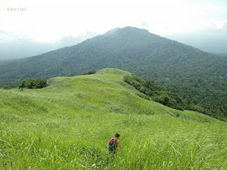
Mt. Atimla has an elevation of 2146 ft. and is usually climb together with the nearby Mt. Kalisungan for a twin dayhike. It takes an average of 6-7 hours to complete the traverse between the two mountains which starts from Kalisungan (entry point is Brgy Lamot) and ends in Atimla (exit point is Brgy Curva).
It lies between the Laguna de Bay and mountain ranges near the Banahaw complex and are surrounded by the famous seven lakes which are bounded by the towns of San Pablo, Nagcarlan, Victoria and mostly part of Calauan, Laguna. Mt. Atimla's summit is characterized by three distinct peaks but only one peak has a established trail and the two is yet to be explored for possible routes.
The descent from Mt. Kalisungan initially features going down through a very steep eastern portion of Kalisungan comprising of almost 70 degrees for about 400 ft. It has a total 1020 ft total descent to reach a valley that commences the assault to Atimla. It was so steep that it was actually my first time to sit and slide down during a descent with nothing else to cling on except the razor-sharp samurai grass.
Upon entering the trails of Atimla, one will be surprised that it is totally a forested woodland that is teeming with red ants, mosquitoes and a wide array of insects (It is recommended to wear long sleeves). From the valley, one has to ascend another 700ft to reach the summit which is like a jungle as seen from Jurrasic era untouched and unexplored. It is steep with no rocks and tree branches to cling on, just pure muscle power.
The summit of Mt. Atimla is like the peak of Mt. Obabis, except that it is larger and the terrain is more varied. Almost like a plateau, except that it’s not very flat. The summit is surrounded by trees and vegetation, thus a 360 degrees view is not possible but one can still take pictures in strategic locations.
How to Get There:
1.) Take a bus bound to Sta Cruz, Laguna (DLTB or Greenstar), their terminal is in LRT Buendia.
2.) Tell the conductor to drop you off in Masapang.
3.) You can then ride a jeepney bound to Calauan/San Pablo tell the driver to drop you off in Brgy Lamot 2
4.)You will be requested to register and take a guide with you for safety purposes.
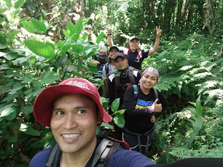
* I hiked with my fellow Team Una friends.


Pede po ba day hike dito
ReplyDeleteHi, pwedeng pwede po ito ng dayhike, it is usually hiked together with Kalisungan for a twin hike. Thanks.
ReplyDeleteVery nice and detailed article. I always love reading Pinoy Solo Hiker's blog posts which also features food reviews and other stuff. very nice indeed.
ReplyDeleteThank you so much Mam. Appreciative readers inspires me to write good articles. Thanks for reading.
DeleteOpen parin ngayun ito sir.
ReplyDeletehi Sir, open nman po ang Atimla un 1peak lng at si Kuya Bino lng po nag iisang guide nagguide dun. Thanks.
DeleteSir, my contact number kayo ni sir bino?
ReplyDeleteHi sir, ito po no. ni Kuya Bino 09994100991
DeleteUpdate.. kuya Bino number 0975 949 1132
ReplyDeleteSalamat po sa info.
Delete