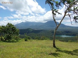
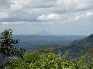
Situated beside the twin lakes Yambo and Pandin, Mt. Mabilog is nestled among the small patches of mountain ranges in Laguna consisting of Prinza, Imok and Obabis. Thus, it has become a hiking favorite for both seasoned and newbie mountaineers due to it's close proximity from Manila.
The most preferred trail starts from Lake Pandin which passes through a series of coconut trees, banana fields, fruit trees and even Lake Yambo. The trail has a total distance of 3 km. with a gradual ascent and only becomes steep in the last 700 meters. It has a total elevation gain of almost 900 ft. from the jump-off point and has a total elevation of 1447 ft. above sea level (My wife and I were able to complete the whole trail in just an hour).
Upon arriving at the summit, one will be rewarded with a spectacular view of San Pablo's 7 lakes together with the picturesque view of Mt. Makiling, Banahaw, Cristobal, Malarayat Range and Maculot which can also be seen from a distant horizon.
The summit is a like a big rounded plateau, perhaps that's how it got it's name "Mabilog" which means rounded. A strong breeze and cool gush of wind is present in the summit, making it an ideal place to relax and unwind. It is well maintained; the grass were properly trimmed and the place is clean, ideal for camping that can accommodate 20 to 30 tents.
How to Get There:
1.) Take a bus bound to Lucena (DLTB or Jac Liner), they have terminals in Cubao and LRT Buendia
2.) Tell the conductor to drop you off in San Pablo City (since, bus were not allowed inside the city you will be drop off at Mahalarlika hiway in San Pablo, you can either ride a trike or take a San Pablo bound jeepneys.
3.) Once in San Pablo, ride a jeep bound for Liliw/Nagcarlan tell the driver to drop you off in Lake Pandin (there's a big signage, and you will be required to walk 300 meters to reach the lake).
4.) The registration and guide for Mt. Mabilog is in Lake Pandin


No comments:
Post a Comment