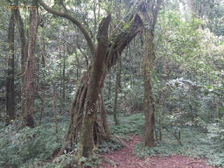
The Malipunyo Mountain Range is an extinct volacano which lies between the provinces of Laguna, Quezon and Batangas. It is popularly known as Malarayat Range, but the locals prefer to call it as Mt. Malipunyo which means "to gone astray/ gone off course" in native language due to it's confusing trails. The name "Malarayat" only came about during the 90's because mountaineers were accustomed to the famous country club located near the foot of Malipunyo.
We had our dayhike traverse which started at Mt. Manabu and ends in Malipunyo's Nampucha trail, passing several peaks along the trail that includes: Mt. Maraduhan, Biak na Bundok, Balite Peak and the three peaks of Malipunyo. The trail was a pure assault of rolling terrains that passes through a forested woodlands, grassland and trails teeming with other noxious plants that includes: "Lipa" and "Teka-Teka" plant (a thorny plant that can easily pierce through clothing and skin), thus, it was named "Teka-Teka"- precaution must be observed to avoid getting pierced/cut.
Malipunyo has 3 peaks, with Peak 3 as the highest which stands at 3278 ft. above sea level, followed by Peak 2 (3128 ft). and Peak 1 (3020 ft.). Peak 3's summit is composed of plants, even a mossy forest and offers a picturesque view Malarayat range and the provinces of Laguna and Batangas. It can accommodate up to a 50 people. Peak 2's summit is much smaller and can only accommodate a handful of 5 to 10 people. On the otherhand, Peak 1's summit is covered with tall trees and shrubs, thus a picturesque view is not possible.
"Nampucha trail" commenced the descent to the traverse trail which is very steep that passes through moist rocks, slippery roots from overgrown trees and the ever present noxious plants that makes the descent more challenging. Several dried up river and a waterfalls can be seen along the way to the exit point.
We were able to complete the reverse-traverse trail (Manabu to Malipunyo) in 7 hours and 52 mins. making it one of the fastest traverses for a group composed of more than 10 members. It has a total distance of 21.5 km. based on my GPS mapping.
Peak 2
Peak 3
Malipunyo Range
 |
| As seen from Los Banos, Laguna |
 |
| Teka-Teka |
 |
| Old Balite Tree |
 |
| Team MX3, the blogger was second to finish the traverse. |
How to Get There:
1. Ride a bus bound for SM Lipa.
2. Alight in SM Lipa and look for the tricycle station.
3. Tell the tricycle driver that you’re going to Mt. Manabu. They’ll take you to the Barangay Hall where you have to pay the environmental fee. Then they will drop you off at Sulok in Sta. Cruz, Sto. Tomas, Batangas.
***I joined an event organized by Diwata Tours**
***I joined an event organized by Diwata Tours**


Been there, it should have a much higher rating of difficulty.
ReplyDeleteTama, dapat iconsider din sa rating of difficulty yung water source at talagang nakakaligaw un trail.
Deletethanks in advance sa tip sir.we will going to climb it dis comin sunday :)
ReplyDeletethanks Sir for reading. Ingats po.
DeleteDo you have contact guide in malipunyo?
ReplyDeleteHi Sir, ito po no. ni Kuya Mario as of 2016 p 09994106990 not sure if yan p din. thanks.
DeleteMay campsite po ba sa malipunyo?
ReplyDeleteyup, may campsite po dun pra s mga nag oovernight.
DeleteHello Sir! Salamat sa useful blog. May question lang po ako regarding sa guide fee dyan sa Malipuño. Magkano po ang singil nila? We're planning a hike this coming february and your response will be a good help. Salamat po!
ReplyDeleteHi Sir, hindi po ako 100% sure if 1k ang bayad s guide pag Malipunyo traverse dayhike, pero more or less parang ganun since last akyat ko nun 2016. Thanks.
Delete