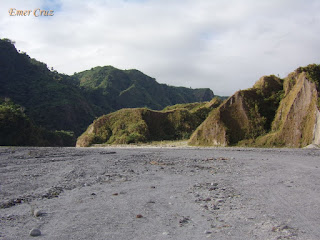
Regarded as one of the most popular tourist destinations in the country, Mt. Pinatubo is located between the provinces of Pampanga, Zambales and Tarlac.
When Mt. Pinatubo erupted in 1991, it became the second largest eruption in the 20th century that causes billions of damages to properties, crops and deaths to countless lives. The infamous eruption was felt worldwide spewing tons of sulfur dioxide and volcanic ash (also known as "Lahar") in the air and global temperatures dropped by 0.5 °C in the years 1991-1993.
There are two known ways of going to Mt. Pinatubo's crater; the longer trail known as the "Sapang Uwak" and the shorter one via the "Skyway"- it was named as such because it enabled 4-wheel vehicles to a shorter route to the drop off point to trek the crater.
We chose the latter and rode a 4×4 vehicle that passed by desert like Lahar fields and rocks. After an hour of a bumpy ride, we started a gradual uphill trek from the jump-off point that requires one to two hours of trekking through rocks and boulders. The final leg leads to a cemented stairway that leads to the viewing deck of the summit.
The gem of Mt. Pinatubo is the crater lake which is described as "a wide jewel of blue and green" and the color of the water also changes from blue-green to deep blue depending on the season. According to the tourism officer, the crater was only formed after its climactic eruption in 1991 and is considered as the deepest lake in the country with a surface area of 1.8 km. and a depth of 2000 ft., thus swimming is prohibited.
** There are several groups that offers Mt. Pinatubo 4x4 tour
(I joined an event organized by Adventurous People)


Nice blog Sir.
ReplyDelete